The Gowanus Canal
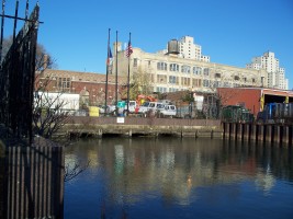
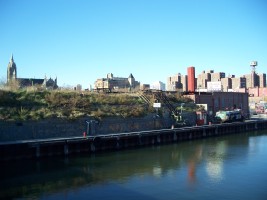
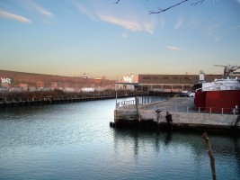
The Gowanus Canal is an industrial canal that was created by straightening and narrowing Gowanus Creek in the mid 19th century. It is located on western Long Island about a mile and a half south of downtown Brooklyn between the neighborhoods of Carroll Gardens and Park Slope.
During the Ice Age, the Wisconsonian ice sheet deposited the material that became Long Island. At the height of the Ice Age (around 18,000 B.C.), sea levels were lower and more of the continental shelf was exposed, leaving the coastline around 50 miles further east and this area as a wooded coastal plain. By 500 to 1000 A.D., the coastline had retreated to basically what it is today and this area became a large saltwater marsh drained by a winding tidal stream. The area was inhabited by the Canarsee, a branch of the Algonquian-speaking Lenape who were semi-sedentary and spread across much of the area between the Delaware and Lower Hudson Rivers. The Canarsee frequented the marsh to harvest oysters and clams.
Europeans began settling the area in the late 16th century. In 1636, Dutch settlers made the first recorded purchases from the Native Americans, acquiring around 15,000 acres in what is now Kings County. The Canarsee were lead by Gowane, a name that was probably corrupted by the Dutch into Gouanes (later Gowanus) and became associated with the marsh and stream. The area was excellent agricultural and pasture land and the marsh provided plentiful game and high-quality oysters. By the mid 18th century, dams and ponds were being built along the creek to feed water mills powered by tidal flows. During the Revolutionary War, the area was the scene of the Battle of Long Island on August 27, 1776.
Development, shipping and industrial activity dramatically increased on the Brooklyn waterfront over the first half of the 19th century although the area retained much of its rural character. The opening of the Erie Canal in 1846 brought an influx of goods from the midwest and an impetus for an even greater boom in development. The marsh was slowly filled in and the creek became a sewer for the surrounding communities.
In 1847, Major David B. Douglass (1790-1849) proposed the first plans for converting the creek into a channel with an upstream tidal basin that would flush the channel (and the collected sewage) into the bay. A few years later, developer, landowner and alderman Daniel Richards (working with city surveyor William Dey) proposed filling in most of the marsh and creating a 5,400-foot-long, 100-foot-wide canal. Although some of the associated basins were never built, the plan largely outlined what would become the Gowanus Canal. Richards' plan was adopted by the Brooklyn Common Council in early 1849, with an authorization to assess property owners for the cost of the construction. Richards' plan for a pier across Gowanus Bay and large basin for a shipping facility lead to a dispute with landowners around the proposed canal, which then lead to a defeat of the canal proposal in the State Legislature. In the absence of a master plan, during the 1850s, local landowners continued filling in the marsh, building bridges across the creek and making modest improvements for navigability of the waterway.
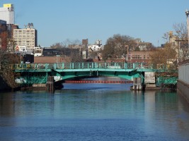
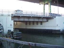
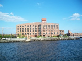
Following the Civil War, efforts to create the canal were revived and in 1866 the Gowanus Canal Improvement Commission was empowered to create a 6,000-foot channel from Douglass Street to Percival Street and to build bridges across the channel. Simultaneously, developer Edwin Litchfield (who in 1852 had purchased marsh land that would include around 1,000 feet of the new canal's frontage) formed the private Brooklyn Improvement Company to build docks and basins on the canal. Between 1866 and 1870, the canal was dredged and enclosed, with Litchfield's company using the dredged mud to complete four 100-foot-wide basins on his property between 4th and 8th streets. An additional basin at 1st street (no longer extant) was added by local owners between 1872 and 1874 and the basin at 11th street was added sometime in the 1880s. As expected the canal provided the catalyst for extensive industrial growth as well as residential development needed for workers.
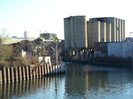
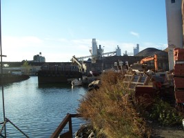
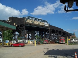
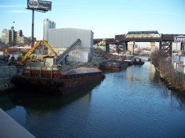
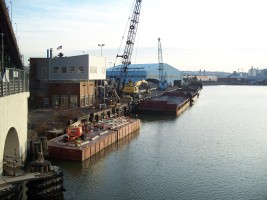
As with the rest of Brooklyn, industrial activity slowly declined on the canal after WW-II, leaving the canal surrounded by abandoned or lightly-used brownfield sites. The flushing tunnel failed in 1962 and was inactive for 27 years. A new sewage treatment plant opened in the old Brooklyn Naval Yard in 1986, relieving some of the problem with raw sewage being dumped into the canal, although sewer overflow outlets still drained into the canal in heavy rains. The flushing tunnel was restored in 1999 as interest was growing for redevelopment of the area around the canal as yet another playground for the wealthy and powerful.
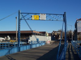
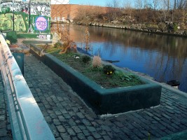
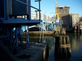
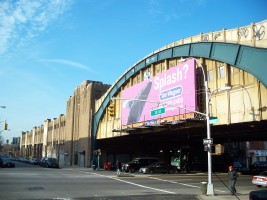
This tour basically follows the canal and surrounding areas from north to south.
There is a considerable amount of information on the canal and redevelopment proposals on the web, including:
- The definitive source for history and construction info on the Gowanus Canal is the Eligibility Evaluation and Cultural Resources Assesment for the Gowanus Canal, a massive document that was prepared by Hunter Resources for the U.S. Army Corps of Engineers in 2004 for determination of eligilibility for the National Register of Historic Places.
- US Army Corps of Engineers Gowanus Canal and Bay Restoration Study
- Forgotten-NY page on the Gowanus Canal
- Gowanus Lounge
- Brownstoner.com
- Canal chronology from an MIT student