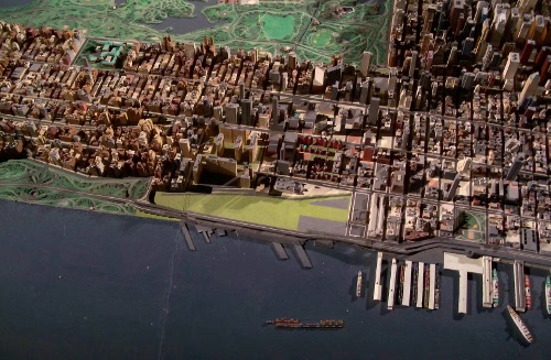
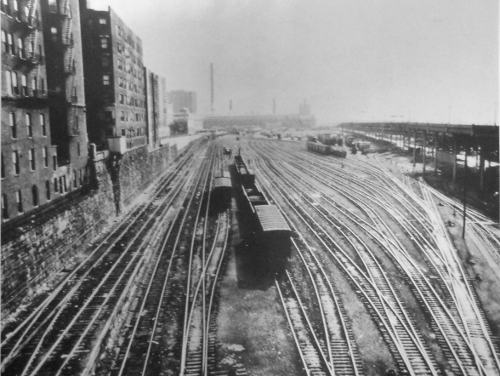
60th Street Railyard
New York City is surrounded by water - which makes it difficult for rail freight to get around the city. Although there are three sets of rail tunnels between New York City and New Jersey, they are used exclusively for passenger service and the nearest freight crossing of the Hudson is 140 miles north in Albany. During the heyday of rail transportation in the early 20th century, railroads got around this problem by transporting rail cars on ferries between the various port and industrial facilities around the five boroughs and New Jersey. One such transfer facility was the 60th Street Rail Yard on the Hudson River between West 72nd and 59th streets in Manhattan.
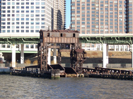
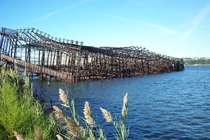
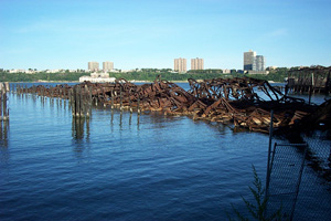
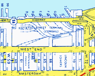
The 60th Street Railyard included six warehouse piers and three float bridges for transferring rail cars from car float barges to the railyard's tracks. The piers were given letter names B to I from south to north to distinguish them from the numbered piers to the south. A 1991 Hagstrom NYC map gives no piers A or C. The float bridges are located between Pier G on the south and Pier I on the north and may have been a Pier H at some point in the past.
With the rise of long-distance trucking after World War II and the move of most port activity to new containerized facilities in New Jersey, activity at rail transportation facilities in New York City began to decline.
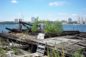
Although a historic marker in the park says the railyard closed in 1971 after the Penn Central went bankrupt, I have seen a photo from as late as 1974 showing it quite active with rail cars and truck trailers. A fire on June 9, 1971 destroyed warehouse piers E, F and G and partially destroyed Pier D. Regardless, they had ceased to have significant value since the advent of containerization in the 1950s, which made hand loading of ship cargo (lighterage) obsolete and moved most of New York City's ship cargo activity to newer ports in New Jersey.
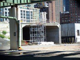
Donald Trump first set his sights on redeveloping the area when he purchased an option for the property from the bankrupt Penn Central railroad in 1974. Following a 20-year sequence of audacious proposals that were shot down by equally vociferous community opposition, a plan developed in a debt-induced compromise with civic organizations resulted in the Riverside South Planning Corporation (RSPC). While Trump remained the public face of the project, he sold controlling interest in the project to a consortium of investors in 1994 and ceased having active involvement in the project in 2001. lost actual control Construction finally began in 1997.
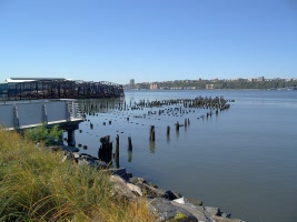
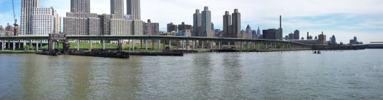
Part of the agreement with the city involved creation of a park along the Hudson River. In 2001, sections of the park with a bike path opened to the public and there have been progressive improvements to the park since.
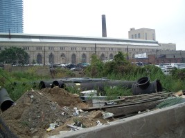
Whenever the railyard did close in the 1970s, what was left of the pier structures began to disintegrate from (nature and vandals) and by the time the pier area was opened as a crude park in 2001, all of the infrastructure had become ruins. Most of the ruins were removed within a few years for the creation of Riverside Park South, although some were integrated into the newly designed waterside park. The landscape design is by Thomas Balsley Associates.
Photos of the park, remnants of the railyard and the Riverside South development are included in this section.