Regions of the United States
One approach to organizing information about the world is to divide it into regions, which are " broad geographic areas distinguished by similar features" (Merriam-Webster 2019). While this approach often requires creating arbitrary artificial borders where the boundaries are really ambiguous or debatable, is it still useful for a variety of applications in business, government and the military.
Geographic regions are commonly grouped into four different types (Getis et al. 2014, 14), and this tutorial will describe examples of some of these types of regions within the United States:
- Administrative regions are "created by laws, treaties, or regulations."
- Formal regions (uniform regions) are areas of "essential uniformity for a single physical or [social] feature or a limited combination of physical or [social] features."
- Functional regions (nodal regions) are focused on a central point, with diminishing influence the further you go away from that central point.
- Vernacular regions (perceptual regions) are areas that are socially-defined by shared history and common identities. Accordingly, the boundaries of these regions are ambiguous and fluid (Wikipedia 2020).
These regions are listed from approximately east to west, and mostly based on the census regions and districts defined by the US Census Bureau (2013). Conveniently, these regions also largely reflect the vernacular names commonly used to refer to different parts of the country.
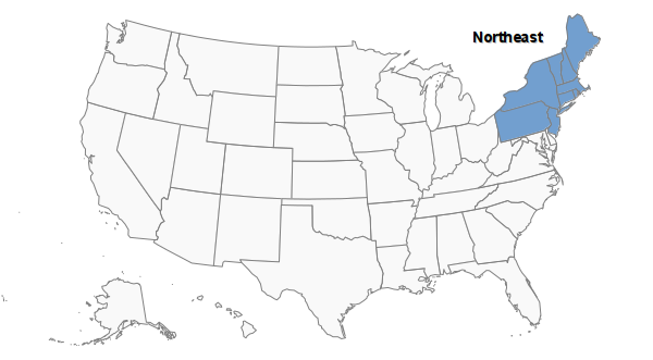
Northeast
The Northeast is a region encompassing New England, plus New York, New Jersey, and Pennsylvania.
New England
New England is a formal region with a rich English colonial history that contains Connecticut, Maine, Massachusetts, New Hampshire, Rhode Island, and Vermont.

East Coast (Formal)
The East Coast as a formal region encompasses the states with coasts on the Atlantic Ocean, (Wikipedia 2020).
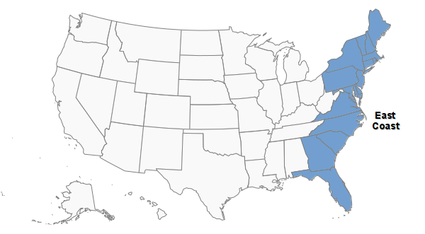
East Coast (Vernacular)
The term East Coast often refers to a vernacular region containing a densely populated urban corridor between Boston, New York City, Philadelphia, and Washington, DC that is the center of US economic and political power.

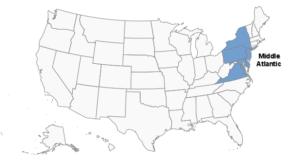
Middle Atlantic
The Middle Atlantic (sometimes abbreviated as Mid-Atlantic) is a vernacular region encompassing the East Coast states between New England and the South Atlantic states (Wikipedia 2020).
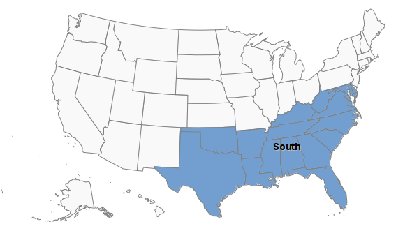
South
Alabama, Arkansas, Delaware, District of Columbia, Florida, Georgia, Kentucky, Louisiana, Maryland, Mississippi, North Carolina, Oklahoma, South Carolina, Tennessee, Texas, Virginia, West Virginia
Appalachia
Appalachia is a formal and vernacular region surrounding the Appalachian Mountains covering parts of Pennsylvania, Ohio, West Virginia, Virginia, Kentucky, Tennessee, the Carolinas, Mississippi, Alabama, and Georgia (Wikipedia 2020).

South Atlantic
The South Atlantic is a formal region containing states with coasts on the Atlantic Ocean: Delaware, District of Columbia, Florida, Georgia, Maryland, North Carolina, South Carolina, Virginia, West Virginia.

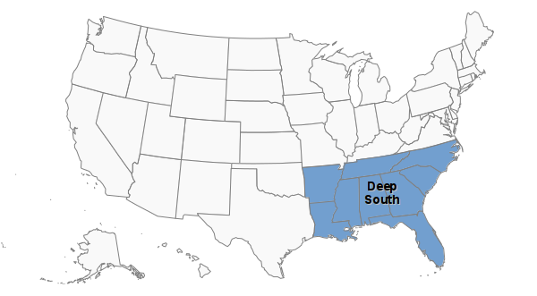
Deep South
The Deep South is a vernacular region in the southeast that usually refers to the states of the 19th century Confederate States of America that are unified by a common set of political and aesthetic characteristics (Wikipedia 2020)
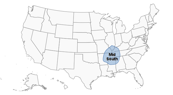
Mid South
The Mid South is a functional economic region around Memphis that encompasses parts of Tennessee, Illinois, Missouri, Kentucky, Mississippi, and Alabama (Wikipedia 2020).
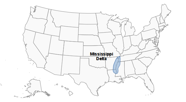
Mississippi Delta
The Mississippi Delta is a vernacular region south of Memphis in the floodplain of the Mississippi River (Wikipedia 2020).
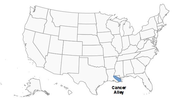
Cancer Alley
Cancer Alley is a vernacular region containing a significant amount of industry around the Mississippi River between Baton Rouge and New Orleans (Wikipedia 2020).
Midwest
The US Census Bureau defines the Midwest as an administrative region encompassing Illinois, Indiana, Iowa, Kansas, Michigan, Minnesota, Missouri, Nebraska, North Dakota, Ohio, South Dakota, and Wisconsin. It is, to a great extent, defined by the regions around it, including states west of the Northeast, east of the West, and north of the South.

Rust Belt
The Rust Belt is a vernacular region in the Midwest and around the Great Lakes that was a hub of American manufacturing in the late 19th and early 20th centuries, but experienced deindustrialization in the second half of the 20th century. (Wikipedia 2020).

West
The US Census Bureau defines the West as an administrative region including Alaska, Arizona, California, Colorado, Hawaii, Idaho, Montana, New Mexico, Nevada, Oregon, Utah, Washington, Wyoming.
Formally, the region also largely encompasses the area west of the Continental Divide that separates watersheds that drain west to the Pacific Ocean from watersheds that drain east to the Mississippi River.

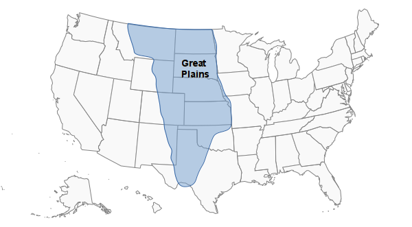
Great Plains
The Great Plains is a formal region covering a broad, flat area in the middle of the US that covers Kansas, Nebraska, North Dakota, and South Dakota, and parts of Colorado, Iowa, Minnesota, Montana, New Mexico, Oklahoma, Texas, and Wyoming. (Wikipedia 2020).
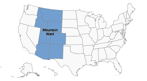
Mountain West
The Mountain West is a formal region that encompasses states around the Rocky Mountains: Arizona, Colorado, Idaho, New Mexico, Montana, Utah, Nevada, Wyoming
(Desert) Southwest
The Desert Southwest is a formal region of largely arid southwestern states: Arizona, California, Colorado, Nevada, New Mexico, Oklahoma Texas, Utah (Wikipedia 2020).

Pacific Northwest
The Pacific Northwest is a vernacular region encompassing Washington, Oregon, and Idaho. The US Census Bureau also includes Alaska and Hawaii in their administrative Pacific division

West Coast
The West Coast as a formal region encompasses states having coasts on the Pacific Ocean: Washington, Oregon, California. The term is also used in a vernacular sense to refer to the dense areas around Los Angeles and San Francisco that are a center for entertainment and liberal politics (Wikipedia 2020)

Functional Regions
Functional regions (nodal regions) are focused on a central point, with diminishing influence the further you go away from that central point.
Metropolitan areas are examples of functional regions. For example, the Denver metropolitan Area has a single administrative region at its core (the City of Denver) but includes a number of surrounding administrative regions (such as Aurora and Arvada) that have strong economic ties to the core city.
The US Census Bureau defines metropolitan statistical areas (MSA) that roughly reflect the areas covered by metropolitan areas, and MSAs are commonly used for demographic and economic analysis.
