Map Elements
This tutorial will describe some fundamental cartographic elements used to create maps.
Framing Elements
The mapped area is the region of the earth being represented.
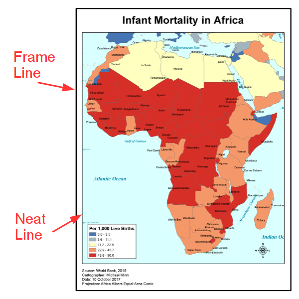
Frame lines are used on maps to help clearly delineate the map content. Frame lines are often drawn to contain all map elements, and on paper maps are separated from the edge of the page by a fixed margin width.
Neat lines are borders placed around individual map areas within a layout.
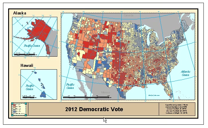
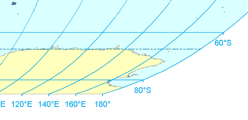
Inset maps are smaller maps included within the context of the larger map. Inset maps are often used to give close-up views of specific areas within the broader mapped area, or show related but spatially discontinuous areas, as with insets of Alaska and Hawaii on a map of the USA.
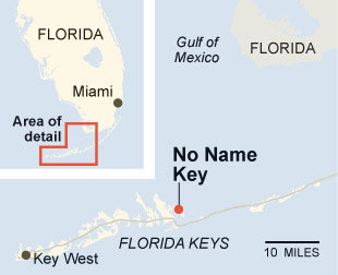
A special case of an inset map is a key map which shows an area larger than the mapped area, but contains a box or highlighted area giving geographic context for the location being mapped.
Marginalia
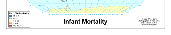
Marginalia is additional information that helps explain or support the map. While, as the name implies, this material is often placed in the margins of the map, the term is more-generally used to include explanatory material placed anywhere on the map.
Most maps have a title that succinctly summarizes the contents of the map or the area represented. Some maps have an additional subtitle that provides additional descriptive information. Additionally, maps should have documentation of:
- Cartographer
- Date
- Data source
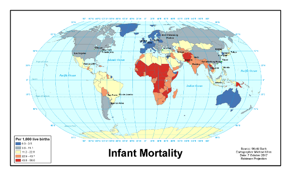
A legend defines all of the thematic symbols on the map.
Scale and Orientation
Although cartographic convention places north at the top of the page, this is not always the case, notably in situations where a map is rotated to reflect usage or display situations where a north-up orientation would be confusing. A north arrow is used to indicate which direction on a map is north.
In cases where the projection causes the direction of north to be different at different parts of the map, a north arrow is not literally correct, although they may still be used to clarify general orientation.
A graticule is a set of grid lines separated by a regular distance or number of degrees. Parallels show the latitude and meridians show longitude.
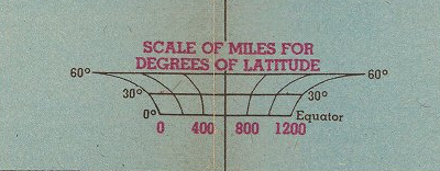
A scale bar can be used to show how land distance is represented by space on the map.
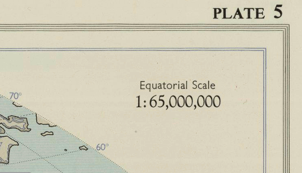
On print maps, a representative fraction is a ratio sometimes used to indicate how much distance on the surface of the planet a given distance along the surface of the map represents. In the example below, 1:65,000,000 means that one inch on the map represents 65,000,000 inches (~1,026 miles) along the Equator. In the case of projected maps where distance is distorted at different amounts in different parts of the map, the distance at the Equator is often used for simplicity.
Representative fractions are less useful for maps displayed on electronic devices since the physical distance on a display is dependent on the specific computer hardware and software being used to view the map.
Typography
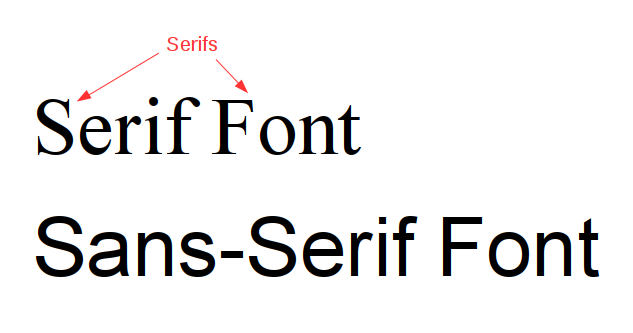
There are a wide variety of different typefaces or fonts used for map text. However, typefaces generally fall into two categories. Serifs are short lines or ornamentations stemming from the upper and lower ends of the strokes of a letter. Fonts that have letters with serifs are called serif fonts. Fonts without serifs are called sans-serif fonts.
Annotating a David Rumsey Map
This video describes how to download a map from DavidRumsey.com and annotate map elements as a class exercise.
- Export a large map image .zip file from DavidRumsey.com into your Downloads folder. This example uses Alexander Keith Johnston's 1850 Geological Structure of the Globe
- Open the .zip file and extract the .jpg file of the map
- Create a new Google Slides presentation from Google Drive
- Remove the title and subtitle boxes so you have a blank slide
- Insert the image onto a Google Slides slide
- Add text box annotations with arrows
- Give your presentation a meaningful name
- Share the presentation and Get sharable link
- An example image of the finished product is here...