Distance
There are multiple ways of measuring distance that are relevant in GIS (UCGIS 2019).
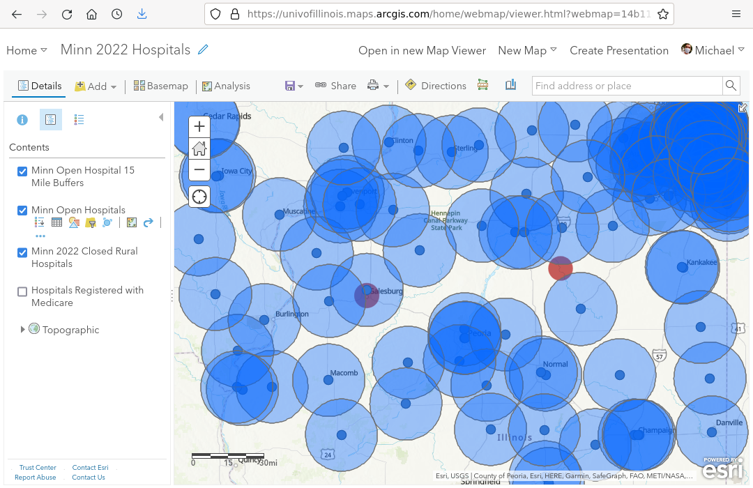
Euclidean Distance
Euclidean distance is calculated from the coordinates of the start and end points using the Pythagorean theorem. This type of distance is named after the Greek mathematician Euclid (c.a. 325 - 370 BC) who is often referred to as the father of geometry (Wikipedia 2022).
When used with unprojected latitudes and longitudes, Euclidean distance has little physical meaning since spacing between lines of longitude varies depending upon the distance from the Equator.
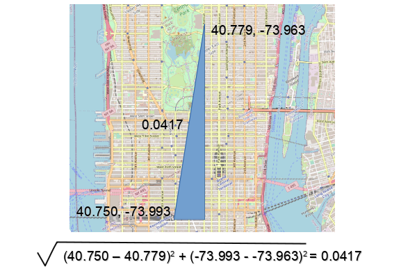
When used with a planar coordinate system like the State Plane Coordinate System, the values estimate ground distance if you could walk in a straight line from one point to another. This is the distance from New York City's Pennsylvania Station (a major transportation hub) to the Metropolitan Museum of Art using the NAD 83 (2011) New York Long Island SPCS Zone (EPSG 6538).

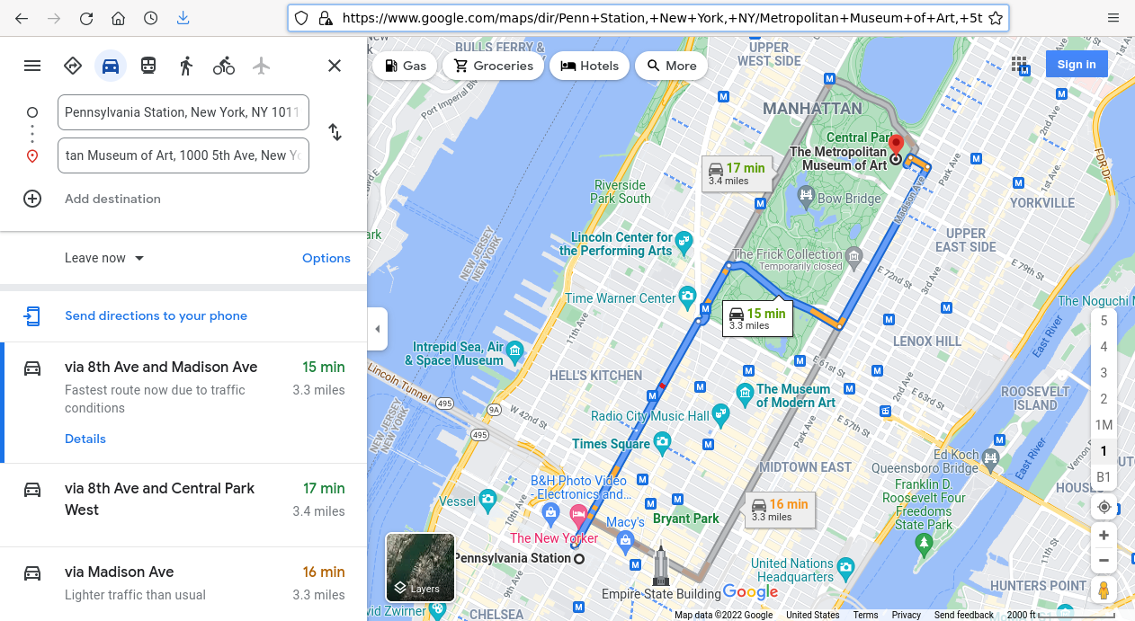
Manhattan Distance
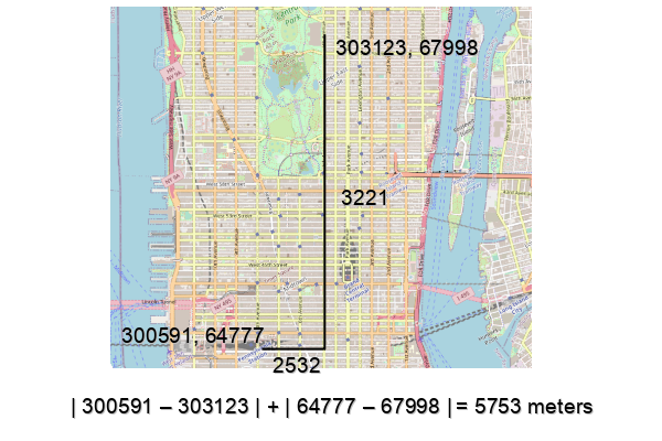
Manhattan distance is the sum of the absolute values of the differences between the X and Y coordinates. This type of distance is named because the distances reflect walking on a rectangular street grid like that in New York City where distances between two points are often longer since you can usually only walk north-south or east-west.
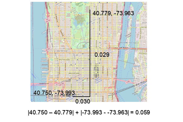
Manhattan distance when used with a planar coordinate system is a good estimate for walking or driving time.
Geodesic Distance
Geodesic distance uses the latitude and longitude of the start and end points, but uses complex three-dimensional mathematics (such as the Haversine formula) to estimate the physical distance across the three-dimensional surface of the spheroidal earth. Geodesic distance is also referred to as great circle distance.
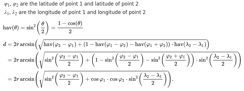
Geodesic distance is a good estimate of the flying distance between two points. When plotted on a map with a cylindrical projection (like the Mercator projection used on web maps), the path will look curved, although the ground distance is shorter than a straight line across the map.
Geodesic distance can also be used for buffering to estimate areas of influence around features. While the distances represented may not be exactly the ground distance, analysis with buffers usually does not require a high level of accuracy, and geodesic distance is comparatively easy to calculate in software.
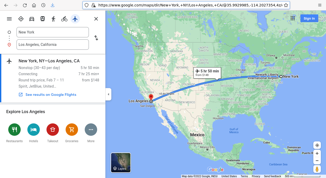
Network Distance
Network distance is calculated as the sum of the traveling distance between two points when you need to go through a network of streets, sidewalks, or other types of transportation links.
In contrast to the completely mathematical techniques for distance calculation given above, network distance requires the use of complex databases for maintaining information on transportation links. These databases require considerable cost for creation and maintenance. Accordingly, such distances are commonly only available through "free" cloud services where your searches are harvested for marketing research (Google, Bing), or from commercial services (ESRI) where you pay a small amount for each calculation performed.
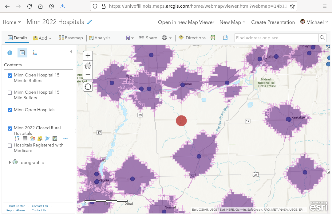
Network distance is commonly used in mobility and accessibility analysis. Drive-time analysis or walk-time analysis uses network distance databases with information about travel time between nodes in the network to estimate total travel time. In commercial applications, comparison can be performed between different routes through a network to find the optimal routes for moving goods or providing services.
For example, the map below shows 15-minute drive-time buffers to hospitals around Streator, IL that can be used to assess whether an area has timely access to emergency hospital services. Such buffers give a more realistic assessment of accessibility than geometric geodesic buffers.