Creating Municipal Land Use Maps with ArcGIS Pro
Rev. 29 August 2025
Despite the ubiquity and utility of the interactive maps commonly used by cities to distribute geospatial information to residents, there are still situations in municipal government where traditional static maps need to be incorprated into documents both for printing to paper and for archival preservation.
One notable example is land use maps used in city and county comprehensive urban planning documents. Comprehensive plans are official documents periodically created by city urban planning departments to encode a vision for the future of the city and serve as a policy guide to help lawmakers achieve that vision (Conglose 2021). While such plans are often highly contested, and are routinely ignored by decision-makers, they can be useful, detailed records of the condition of city infrastructure and form at the time they were created, as well as a useful historical record of the aspirations of city leaders.
Comprehensive plans contain a wide variety of geospatial information, often in the form of maps. Accordingly, they are rich source of examples for students of cartography who aspire to work in city agencies.
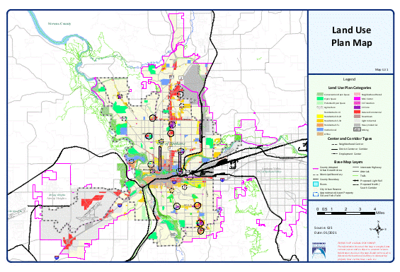
This tutorial will use Bloomington, IL (2020 population 78,680) as the city for an example land use map.
Land Use Polygons
Zoning is "the act or process of partitioning a city, town, or borough into zones reserved for different purposes (such as residence or business) (Merriam-Webster 2024).
- Cities began passing laws in the late 19th century prohibiting "nuisance" businesses (notably slaughterhouses) from specific areas of cities, and that practice evolved into comprehensive zoning codes that first emerged in New York City in 1919.
- Zoning enhances property values and quality-of-life in selected areas of cities while also reinforcing segregation by class and race (Furth 2019, Metzenbaum 1957).
- Most major US cities and / or counties have zoning codes.
Open data is "data that can be freely used, re-used and redistributed by anyone - subject only, at most, to the requirement to attribute and sharealike" (Open Knowledge Foundation 2018).
A fundamental value of open data is interoperability, which is "the ability of diverse systems and organizations to work together" and intermix different datasets (Open Knowledge Foundation 2018). When people can work together with a minimum of restrictions, this results greater individual productivity that, ideally, benefits society as a whole.
Many planning departments in large and medium-sized cities make their data freely available to the public via open data portals. These portals often use Socrata or ESRI's ArcGIS Hub software.
- You can usually find open data portals for a city by Googling the city name and "open data."
- Download options commonly include shapefiles, file geodatabases, and GeoJSON files. Although all three formats can be imported into ArcGIS Pro, the shapefile is usually the safest and easiest option to work with.
Acquire the Data
The McLean County GIS consortium makes zoning data for Bloomington, IL available for download as a zipped shapefile through their data portal.
- Acquire: Download and unzip the shapefile.
- Store: Run the Export Features tool to copy the zoning data from the shapefile into a new feature class in the project geodatabase (Zoning).
- Storing the data in the project geodatabase will improve performance and reduce the chances that the data is lost when changing machines.
- Note that you need to specifically browse into the project geodatabase and provide a name, or the shapefile will simply be copied to a different shapefile.
When accessing data from sites using ArcGIS Hub or ArcGIS Enterprise Sites, data may be available as feature services that you can use with the Export Features tool to copy the zoning data into a new feature class in the project geodatabase. The video below demonstrates downloading zoning data for Peoria County, IL using a feature service (GeoService) provided by the county.
Some agencies only provide web maps of zoning polygons, but if the map layers are provided with feature services, examining the layer information may lead you to a feature service that you can use with the Export Features tool to copy the zoning data into a new feature class in the project geodatabase. The video below demonstrates downloading data from a feature service used as a layer on the city's zoning web map.
Explore the Fields
- Select View Attributes and explore the different fields to find the appropriate zoning or land use class variable. In this data, the field is ZONING.
- Right click on the layer and select Symbology.
- Change the symbology type to Unique Values and choose the land use class field you found above.
Research the Land Use Codes
In large urban areas, fundamental land use types (residential, commercial, manufacturing) can be divided into a dizzying array of subcategories reflecting the contradictory interests and political power of diverse community stakeholders.
The land use classes in your data may be cryptic abbreviations. The definitions of those abbreviations may be defined in the metadata.
In this case, the metadata is useless, but a quick Google search finds a list of potential values in the Municipal Code.
Generalized Categories
Using a large number of land use classes would make a map difficult to read, and grouping them into generalized classes may keep the general point of the map prominent.
For this example, we group maps into five categories:
- Agricultural (A)
- Residential (R*, GAP 1-4)
- Commercial (B*, C*, D*, GAP 5)
- Manufacturing (M*, GAP 6)
- Public (P*)
To group values:
- Select the values you desire to group in the Symbology Unique Values list. Use the ctrl key to select additional values.
- Right click and select Group Values.
- Click on the Label to change it to the name of the group.
Color Palette
Double-click on the color patches to change the colors to contrasting colors.
- One approach to promoting accessibility for folks with red-green color blindness
is to choose colors that are shades of red to blue or green to blue.
The following colors are used in this example:
- Agricultural: Light gray
- Commercial: Light blue
- Manufacturing: Dark gray
- Public: Dark green
- Residential: Light green
- Remove the borders from the land use areas so they do not conflict with the base map.
- Remove <all other values>.
- On the ribbon under Feature Layer and Appearance, change Layer Blend to Multiply so the area colors add tinting to the base map rather than obscure it.
State Plane Projection
In the US, local areas like cities are commonly mapped with a projection from the State Plane Coordinate System (SPCS), which was developed in the 1930s by the US Coast and Geodetic Survey to enable surveyors, mappers, and engineers to connect their land or engineering surveys to a common reference system (Stem 1990).
- You can view this map of different SPCS projections in order to find the EPSG number projection appropriate to the local area.
- The SPCS projections have been modified over the years to reflect improved surveying technology, and you should generally use the most recent version unless you are working on a project that is based on an older projection. For Spokane, we use NAD 83 (2011) US Feet: EPSG:6597.
- Right click on the map Properties and under Coordinate System you can search for the projection by the EPSG number.
- Over small areas like cities, the change from web Mercator to SPCS may make only minimial change in appearance, although the difference from unprojected WGS 84 can be quite dramatic.
Road Layer
A base map is a collection of geographic features that provide geographic context for the thematic symbols that are the focus of the map. Base maps need to provide enough information for readers to understand what is where, but the base map features need to be unobtrusive enough so that they do not clutter or obscure the thematic features.
For maps of urban areas, either road center lines or parcel boundary polygons (which effectively outline roads) are commonly used as the primary base map features. For this example with the complete area of a medium-sided US city, parcels would be too detailed, so we will use a layer of roads provided by the city.
TIGER Road Shapefiles
While some municipalities distribute detailed street data, but often the fields in road data available from cities may be inadequate for clearly classifying or labeling roads. In such cases, you may wish to use data from the US Census Bureau.
The US Census Bureau makes much of their geospatial data available as shapefiles derived from their Topologically Integrated Geographic Encoding and Referencing (TIGER/Line) database.
- Acquire: Visit the TIGER/Line Shapefiles website, download the All Roads shapefile for the county where your municipality is located, and unzip the file.
- Store: Run the Export Features tool to copy the data from the shapefile into a new feature class in the project geodatabase (Roads). Note that you need to specifically select a location in the project geodatabase, or the shapefile will simply be copied to a different shapefile.
Grouped Values
There is a hierarchy of road importance and capacity that needs to be reflected in the map. Interstate highways usually are the most prominent, with decreasing visual intensity down through state highways, arterial roads, and local roads.
- There are two classification fields in the TIGER data that you can use, although neither will likely be perfect for your area: RTTYP (route type codes) and MTFCC (feature class codes).
- Right click on the layer and view the Attribute Table to explore the fields to find the appropriate road class variable.
- Symbolize the the roads as Unique Values.
- A road class variable may have more detailed class divisions than you may need for a base map, and keeping all those clasees will clutter your legend. With RTTYP, I is used for interstates, C, S, and U for arterial highways, and M and missing values for local roads.
- For this example we will form three groups: Local, Arterial, and Interstate.
- For each group, click on the Value of the top member of the group, hold down the Ctrl key, and click to add other members to the group.
- Right click on the selected classes and click Group Values.
- Double click on the group label names to change them to meaningful labels.
- Adjust the symbology to three different thicknesses. Gray is a good choice because the roads are for context and should be in the background.
- Local: 10% gray 0.5 pt
- Arterial: 10% gray 2 pt
- Interstate: Use the interstate line type
- Because larger roads are generally considered more significant than smaller roads, the larger roads should generally be drawn so that they are on top at intersections. This is especially true with limited access roads like interstates that have overpasses over local roads.
- Adjust the order in the symbology so local roads are at the top and interstates are at the bottom, which is the reverse of the drawing order.
Remove Base Map
Once you have a clear road grid, if you haven't already, you should remove the default base map.
Base maps in ArcGIS Pro are the same base maps used in the ArcGIS Online web app, and while they are adequate for low-resolution web maps, paper has a higher resolution than computer screens, and those base maps will likely be fuzzy when printed. The base maps may also contain additional details (like labels or environmental features) that will clutter the map and make it harder to read.
Road Labels
Because this will be a land use map rather than a road map, we will limit the number of road name labels only to the major arterial roads.
This will require creating a label class.
- Click the List by Labeling icon and select Class 1 under your road layer.
- Double click the class name to rename it (Highways).
- Modify the class so it only applies to highways.
- Create the condition Where your road class variable is equal to the type of road you want to label.
- In this example, we label only US highways (U).
- On the Labeling ribbon, under Field, make sure there is a road name attribute selected (FULLNAME).
- Change the Text Symbol Style to be a small, light gray font that will only be vible if you look closely.
- Under Label Placement Style, select North American Streets so the labels are paralell to the road.
- Prevent duplicate labels for multiple lanes or road segments.
- Right click the class, select Labeling Properties..., click the Position group and under the Conflict Resolution, select Remove duplicate labels and select Remove within fixed distance.
-
Select SQL Query, add a New expression
and Create new expression.
Interstate Shields
Interstate highways (and some state highways) have numbers that are placed in shield graphics.
- In the Contents pane, click the List by Labeling icon.
- Right click on the layer and Create Label Class...
- Give the label class a meaningful name (Interstates).
- Modify the class so it only applies to interstates.
- Select SQL Query, add a New expression and Create new expression.
- Create the condition Where your road class variable is equal to the type of road you want to label.
- In this example, we label only interstate highways (I).
- On the Labeling ribbon, under
Field, change the
Expression to isolate the interstate number field.
- If the only fields available begin with "I-" you can remove the prefix using the replace() function in the Expression box.
- For example, if your road name field is STR_NAME, the
Expression would be:
replace($feature.STR_NAME, "I-", "") - In this case we also want to remove the "Bus" business route suffix to make the labeling cleaner, so we add a second replace() to remove that text when present.
- Under Text Symbol Style and scroll down to select one of the Shield icons.
- Under Label Placement Style, select Shield.
- Prevent duplicate labels for multiple lanes or road segments.
- Right click the class, select Labeling Properties..., click the Position group and under the Conflict Resolution, select Remove duplicate labels and select Remove within fixed distance.
Bodies of Water
Lakes, rivers, and streams are notable landmarks (and, sometimes, obstacles) that will often add meaningful context and contrast to a base map.
The USCB has a TIGER/Line Water shapefiles include separate shapefiles for area features (Lakes) and linear features (Creeks).
Rail Lines
Rail lines are often important landmarks that can be useful on a base map, although care should be used so that maps of areas with extensive rail infrastructure are not too cluttered.
Political Boundaries
You will commonly want to add lines for political boundaries to delineate the jurisdiction of the authorities regulating land use. In this case, we use the municipal boundary of the City of Bloomington.
The TIGER/Line Places file contains boundaries for places in states.
- Use the Export Features tool with a Filter to import only the boundary for the desired municipality.
- Right click to select Symbology and remove the fill, since we just need the boundary line.
- Make the outline 6/6 dashed and change the color to black.
- Make sure the layer is the topmost layer so that the boundary lines are not obscured by other features.
Layout
New Layout
Once you have designed your map, you need to create a layout for how that map will be displayed on the printed page.
- Under Insert select Layout.
- Choose a paper size based on the size of the target document. Given the amount of detail in the base map, tabloid (11 x 17 inches) seems appropriate.
- Choose an orientation so your features most fully fill the area. Since this area is slightly wider than it is tall, we use landscape orientation.
Map Frame
- Add a new map frame for the main map area.
- Right click on the map frame and select Properties
and Placement to set the sizing and position.
While you can do this by sight, you can assure clean centering and sizing
by entering numeric values.
- Width: 16 in
- Height: 8 in
- X: 0.5 in from left edge
- Y: 2.5 in from bottom edge
- Activate the map frame and adjust the zoom to fill the frame with the features.
Scale Bar and North Arrow
Because the spatial relationships of areas in cities are often unfamiliar, even to long-time residents, a scale bar gives context for knowing distances between locations on the map.
While maps generally place north on the top edge of the map, this is not always the case, and a north arrow helps viewers understand direction on the map.
Title
- Insert a rectangle text box for the title that can be easily resized.
- Change the text symbol (font) and font size (40pt) as needed.
Legend
Add a legend to the layout.
- Right click on the legend and under the Options tab and Legend Items, select Show Properties.
- Drag legend items in the table of contents into the order desired and adding New Column when needed.
- For each item in the legend, turn off heading names and rename the layers if the original names are abbreviations.
Metadata
- Insert a Rectangle text box for the metadata (date, cartographer, data source).
- Insert a logo for branding. If you are doing this as an academic exercise, you may want to use your institutional logo rather than the city logo so you accurately represent the map source.
- If you are creating a map like this for a government agency, you may need to include a disclaimer to avoid any legal jeapordy for inaccuracies in the data or representations.
Neat Lines
Finally you should add neat lines that separate map elements from each other and give the map a clean, contained look.
You can add neat lines with rectangles. Even though the fill is transparent, you may need to Send to Back in the drawing Order so you can drag the map elements into appropriate locations.
Export PDF
Portable Document Format (PDF) is a standard document format that will usually render identically on different devices and on paper. Accordingly, PDF will usually be the way you want to share your map with other parties.
Save Your Project
When you are done with a project, you should save it as a project package on ArcGIS Online so that you can reopen it later on any computer if you need to use your base map.
- Go to the Share tab and select Project.
- Provide a name to save the project under. The default is the name of the current project.
- Copy the name into the Tags and Summary fields.
- Click the Share outside of organization box so your project database containing all of your layers is included in your project package.
- Unclick the Include Toolboxes and Include History Items check boxes so that history or toolbox errors to not cause your upload to fail.
- Analyze the project to find any problems.
- Package the project to upload it to ArcGIS Online. This may take a minute or two.
Appendix: The National Map
The National Map is a collection of products and services from the US Geological Survey (USGS) that provide access to basic geospatial information about the landscape of the United States and its territories (USGS 2025). Data from the National Map is an alternative when base map data from the USCB is unavailable or inadequate.
National Map data can be downloaded through the TNM Download (v2.0) web app.
Data is available in zipped shapefile, file geodatabase, and GeoPackage formats.
Transportation
USGS National Transportation Dataset consists of roads, railroads, trails, airports, and other features associated with the transport of people or products. The dataset is based on the US Census Bureau's TIGER/Line data set with some modification and augmentation performed by the USGS (USGS 2025).
This video demonstrates how to import a state road feature class into a project geodatabase.
- Acquire: Go to the TNM Download (v2.0) page.
- Datasets: Transportation
- Data Extent: State
- File Formats: GeoPackage
- Zoom to the state and click Search Products.
- Find the data in the search results.
- Right-click on Download Link (ZIP) and download.
- In the File Explorer, right click on the .zip file and Extract all.
- Store: Open the Export Features tool.
- Import Features: Brows to your Downloads folder, find the .gpkg file and the Trans_RoadSegment feature class.
- Output Features: Browse to your project geodatabase and save a new feature class (TNM_Roads).
- A statewide dataset will be quite large and may take a few minutes to export.
- Process: If you have a polygon you can use the Clip tool to clip the very large state dataset to a more specific area.
- Input Features or Dataset: The state roads (TNM_Roads).
- Clip Features: The polygon(s) to clip to.
- Output Features or Dataset: The clipped feature class (Roads).
- In the Catalog Pane, remove the statewide data set to reduce the storage space used by your project.
- Communicate:
- Change the Coordinate System to a cartographically appropriate projection (Web Mercator)
- Symbolize by Unique Values based on the tnmfrc_description
- Repeat with the Trans_RailFeature feature class for railroads.
Hydrography
The National Hydrography Dataset (NHD) represents "the water drainage network of the United States with features such as rivers, streams, canals, lakes, ponds, coastline, dams, and streamgages" (USGS 2025). The NHD was retired in 2023 but as of this writing is the hydrography data set available on The National Map.
This video demonstrates how to import state water body and stream flow line feature classes into a project geodatabase.
- Acquire: Go to the TNM Download (v2.0) page.
- Datasets: Hydrography
- Subcategories: National Hydrography Dataset (NHD)
- Data Extent: State
- File Formats: GeoPackage
- Zoom to the state and click Search Products.
- Find the data in the search results.
- Right-click on Download Link (ZIP) and download. A statewide dataset will be quite large and may take a few minutes to download.
- In the File Explorer, right click on the .zip file and Extract all.
- Store: Open the Export Features tool.
- Import Features: Brows to your Downloads folder, find the .gpkg file and the NHDWaterbody feature class.
- Output Features: Browse to your project geodatabase and save a new feature class (Lakes).
- A statewide dataset will be quite large and may take a few minutes to export.
- Communicate:
- Change the Coordinate System to a cartographically appropriate projection (Web Mercator)
- Symbolize with a blue color appropriate to water.
- Repeat for the NHDFlowline feature class for streams.
Appendix: Cities with Publicly-Available Zoning Data
- Alabama, Tuscaloosa: https://tuscaloosa.maps.arcgis.com/home/index.html
- Arizona, Flagstaff: https://gis.flagstaffaz.gov/portal/apps/sites/#/opendata
- California, San Jose: https://data.sanjoseca.gov/
- Colorado, Pueblo: https://opendata-puebloco.hub.arcgis.com/
- Florida, Stuart: https://city-of-stuart-open-data-stuartfl.hub.arcgis.com/
- Georgia, Savannah: https://data-sagis.opendata.arcgis.com/
- Illinois, Peoria: https://data-peoriacountygis.opendata.arcgis.com/
- Indiana, South Bend: https://sjcgis-stjocogis.hub.arcgis.com/
- Kentucky, Bowling Green: https://data-bgky.hub.arcgis.com/
- Louisiana, Monroe: https://monroela.us/departments/engineering/gis-geographic-information-system/
- Maine, Portland: https://portlandme.maps.arcgis.com/home/index.html
- Minnesota, Rochester: https://www.olmstedcounty.gov/business/building-development-gis/building-well-septic/about-gis-maps-addressing
- Nebraska, Lincoln: https://opendata.lincoln.ne.gov/
- Nevada, Carson City: https://carson-city-hub-carsoncity.hub.arcgis.com/
- New Mexico, Las Cruces: https://communal-data-las-cruces.hub.arcgis.com/
- New York, Rochester: https://data.cityofrochester.gov/
- Ohio, Cincinnati: https://data.cincinnati-oh.gov/
- Oregon, Portland: https://gis-pdx.opendata.arcgis.com/
- Oregon, Salem: https://data.cityofsalem.net/
- Pennsylvania, Allentown: https://opendata.allentownpa.gov/
- South Dakota, Sioux Falls: https://dataworks.siouxfalls.gov/
- Tennessee, Murfreesboro: https://maps.murfreesborotn.gov/PublicGIS/
- Texas, Arlington: https://opendata.arlingtontx.gov/
- Washington, Spokane: https://data-spokane.opendata.arcgis.com/
- West Virginia, Morgantown: https://geohub-morgantownwv.hub.arcgis.com/
- Wisconsin, Fond du Lac: https://www.fdlco.wi.gov/departments/departments-f-m/land-information/data-download
- Wyoming, Cheyenne: https://hub.clcgisc.com/