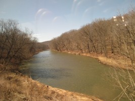
Connellsville, PA
Connellsville was founded in 1793 and later became a major center for coal mining. The Great Allegheny Passage, is a rail-trail that runs between Pittsburg and Cumberland, MD. It is based on an abandoned roadbed that runs parallel (usually to the south) of the former Baltimore and Ohio RR line which became part of CSX and which is the line used by Amtrak for the Capitol Limited. Between Connellsville and Cumberland, the trail runs on the abandoned Connellsville subdivision of the defunct Western Maryland Railway, and portions of that trail are occasionally visible from the Capitol Limited.

Connellsville, PA

Connellsville, PA

Dam on Youghiogheny River
39.995774,-79.593966

Western Maryland RR bridge (Great Allegheny Passage) over Youghiogheny River at Ohiopyle, PA
39.87084,-79.492984

Ohiopyle, PA

Casselman River

Casselman River

Casselman River

Casselman River

Wind Turbines

Casselman River

Wind Turbines
39.848398,-79.06423

Western Maryland RR bridge (Great Allegheny Passage) over Casselman River: 39.834184,-79.045666

Western Maryland RR bridge

Meyersdale Wind Farm
39.828421,-79.03688

Meyersdale Wind Farm
39.802602,-78.99269

Meyersdale Wind Farm

Wills Creek

Wills Creek

Kayakers

Alt 40 Bridge
39.662485,-78.780524