Port Morris Branch: Westchester Avenue Yard
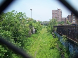
The Port Morris Branch crosses under Westchester Avenue between Brook Avenue and St. Ann's Avenue. The White Plains Road line of the IRT (#2 train) emerges from a tunnel just east of the Port Morris Branch and is elevated over Westchester Avenue when it crosses the Port Morris Branch.
The area just north of Westchester Avenue between Brook Avenue and St. Ann's Avenue seems to have been the Westchester Avenue Yard at an intermediate point between the Oak Point yard to the south and the connection to the Harlem Line to the north. The southern part of the yard area was taken over by South Bronx High School for multi-sport athletic fields (the Merrill Lynch Field of Dreams), but a corridor was left for the rail line right-of-way and there was a pedestrian bridge over the line.
Unfortunately, for the circumferential line, the crossing was about equidistant between the 3rd Ave./149th Street Station to the west and the Jackson Avenue Station to the east, making a extremely unlikely that a tunnel or viaduct could have been built for direct transfer between the circumferential subway and the IRT. However, there was a post office and vacant lots adjacent to the tracks at this point, so this still could have been a good spot for a station. Curiously, my 2006 Hagstrom map gives the path of the Port Morris Branch as Hegney Place and there is a corresponding street sign on the south side of Westchester Ave. Hegney Place does run intermittently along the tracks north of here, so perhaps there is/was consideration of filling in the trench and conversion to a street.
West of the Westchester Avenue yard is a vibrant shopping district on Third Avenue.
Parts of a wall have what appears to be some kind of Art deco ornamentation. However, a gentleman who used to work for NYC Transit told me that they are probably clay liners for cable ducts that separated power cables for the third rail. Some of the ducts appear to be covered over with a concrete shell that was presumably removed when the cables were removed - either by the railroad or by metal scavengers from the neighborhood.
In 2012, Via Verde opened and covered a portion of the ROW just south of East 156th street, and the bridges north of 156th Street were filled in. This severed the line and reduced the possibility of reuse for transit.

Line hidden behind trees, viewed from the east on the Westchester Ave. IRT

Under the IRT Jackson Ave. Station

St. Mary's Park Houses

The Westchester Ave. IRT headed south

Under the IRT

IRT passing the prison on Westchester Avenue

IRT over Westchester Avenue at Eagle Avenue

The IRT descending into the tunnel at Bergen Avenue

Church and row houses on Caldwell Ave.

Substation off the Westchester Ave. IRT

13,200 volts

Post Office off St

Westchester Ave. IRT crossing over the Port Morris Branch

Port Morris Branch headed north from Westchester Ave. - site of future subway station?

Westchester Ave. bridge over the Port Morris Branch

Overgrown Port Morris Branch headed south from Westchester Ave.

Sign for Hegney Place off Westchester Ave. at the Port Morris Branch trench

Breeched fence beside the trench, giving squatters access

#2 IRT train passing over the trench

Vacant lot east of the tracks and south of Westchester Ave. - potential station location?

Older row houses and newer apartment buildings on St. Ann's Ave.

Jet leaving Laguardia Airport - there is considerable jet noise in this neighborhood

Third Avenue retail block

Third Avenue retail block

Third Avenue retail block

Third Avenue retail block

Older building off Third Avenue

Vacant lot west of the Westchester Avenue Yard

Vacant lot west of the Westchester Avenue Yard

Field of Dreams

Field of Dreams track

Field of Dreams baseball diamond

Old yard retaining wall by the Field of Dreams

Brooke Avenue along the Field of Dreams

Brooke Avenue running along the trench at 157th Street

Open area in the Westchester Avenue Yard north of the athletic fields

Westchester Avenue yard

Cable ducts

Cable ducts

Westchester Avenue Yard Retaining wall

Westchester Avenue yard looking north into the trench

Cable ducts on the south side of the bridge

Looking south on the right of way and the old railyard

Long-dead car in the old railyard

The pedestrian overpass over the right-of-way

Residual gravel ballast on the right-of-way

Track use restriction sign

Closed gate on the pedestrian overpass prohibiting access to the field of dreams

Looking north on the right-of-way under the pedestrian bridge

Old cast iron fence where Rae Street dead ends into the right-of-way

Fence ornament closeup

Fence around Crotona Academy - school looks like a prison

South Bronx High School

Front entrance to South Bronx High School - listing academies

The rear (west side) of South Bronx HS

Looking south on St. Ann's Avenue toward the elevated IRT line

Old tenament that survived the 70s across from the school-with Puerto Rican flag

Newer low-rise public housing across from the school - where tenaments didn't survive the 70s

Bronxchester Houses

Bronxchester Houses

Parking lot on a hill - 156th Street at St. Ann's Avenue

156th Street bridge over the Port Morris Branch

North side of the 156th Street bridge

Trench between 156th and Brook Avenue tunnel

Port Morris Branch north from Westchester Avenue
40.816587, -73.912735

Rae Street terminating at the Port Morris Branch
40.817510, -73.912361

Pedestrian overpass
40.817809, -73.912413

Pedestrian overpass

Field of Dreams

Via Verde

Via Verde

Via Verde

Via Verde

Via Verde

Via Verde

Via Verde

East 156th Street Bridge
40.819663, -73.911856

East 156th Street Bridge

East 156th Street Bridge

Filling of Five Bridges

Residual trench north of 156th Street

Residual trench north of 156th Street