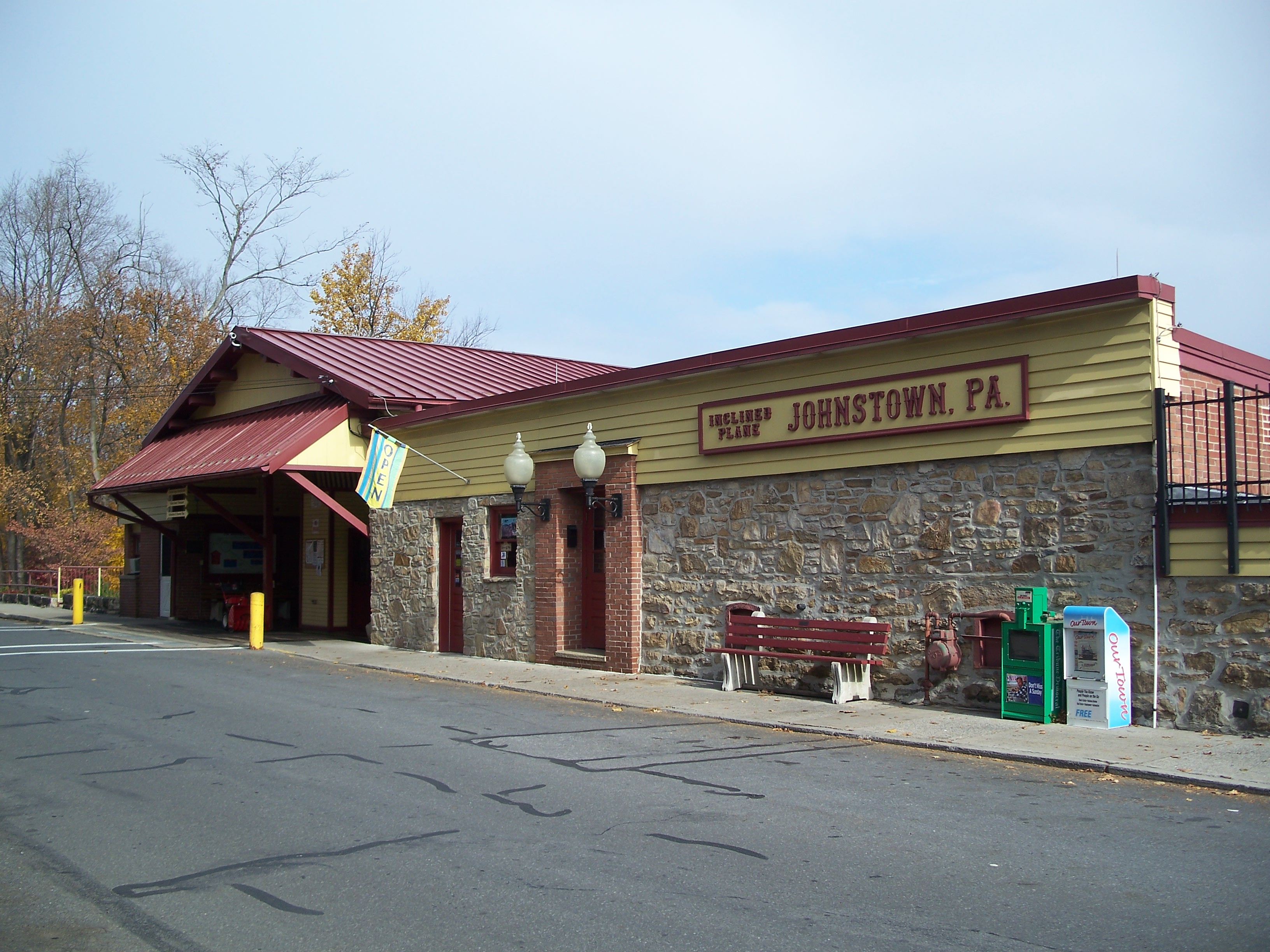
Johnstown Inclined Plane
Johnstown, PA
After the 1889 flood, the Cambria Iron Company purchased the hilltop just to the west of Johnstown, PA to provide a safer place for their management to live than the flood-prone valley. At the time, Yoder Hill was a farming area, and the company commissioned landscape architect Charles Miller to lay out the suburban residential district that was eventually named Westmont. Because roads to the hilltop were steep and unreliable, the company constructed this inclined plane to transport people and vehicles from Westmont down to the city and factory in Johnstown below. (reference)
The inclined plane is essentially a vertical cable-driven railway running 897 feet down a 71% grade. It was designed by Samuel Diescher (1839-1915) and is similar to other inclined planes built in mountainous western Pennsylvania during the late 19th century. A Pennsylvania Truss bridge at the base of the plane permits passengers and vehicles to cross Stonycreek River. Although probably not envisioned as an escape route, the incline plane is credited with saving 4,000 lives during the great flood of 1936. The plane was condemned during the 1970s, but was rebuilt and rededicated in 1984.
A 237-foot Pennsylvania Through-Truss bridge sits at the base of the inclined plane, permitting passage across the Stonycreek River.
Upper station of the Inclined Plane
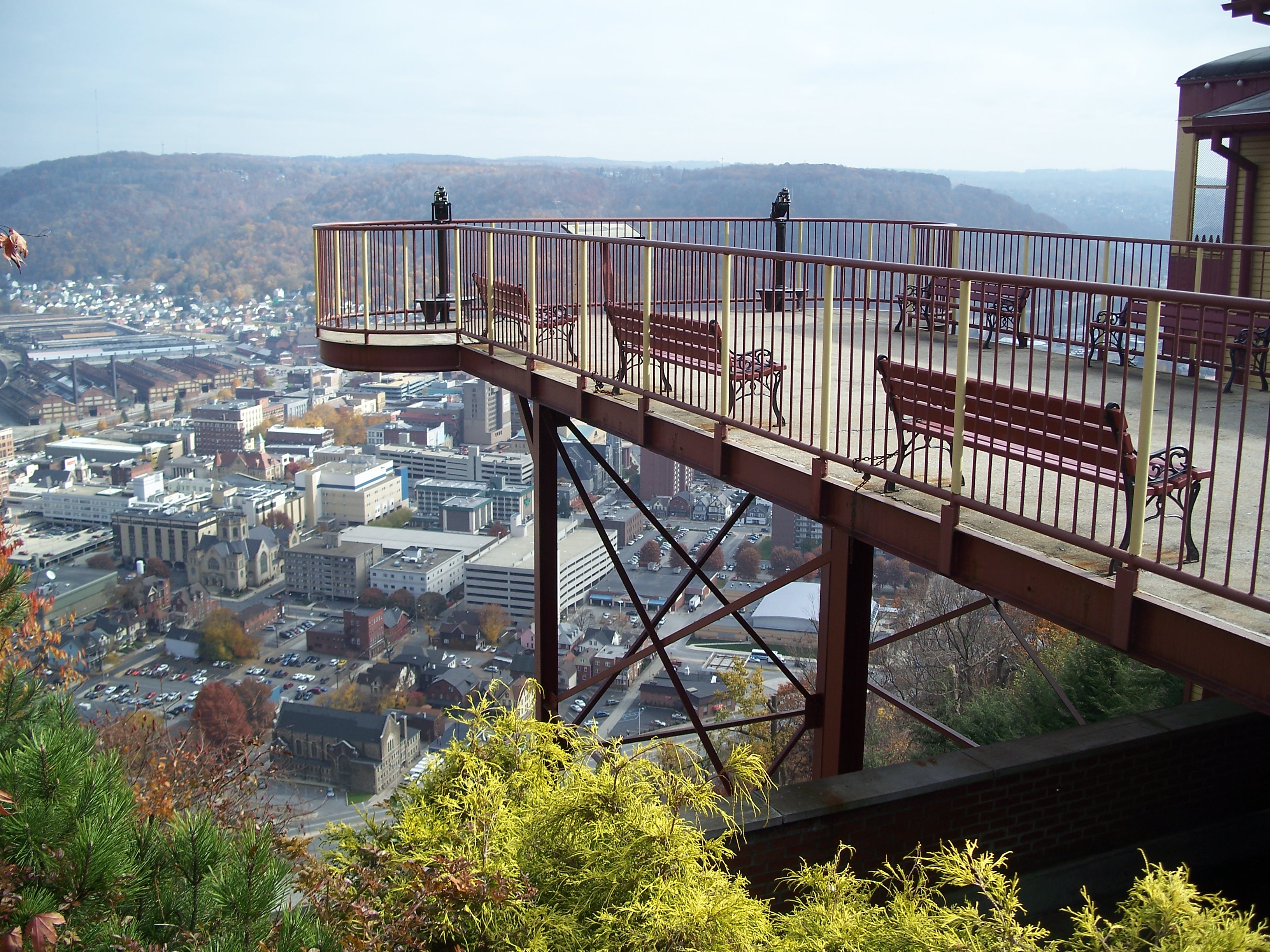
Observation deck
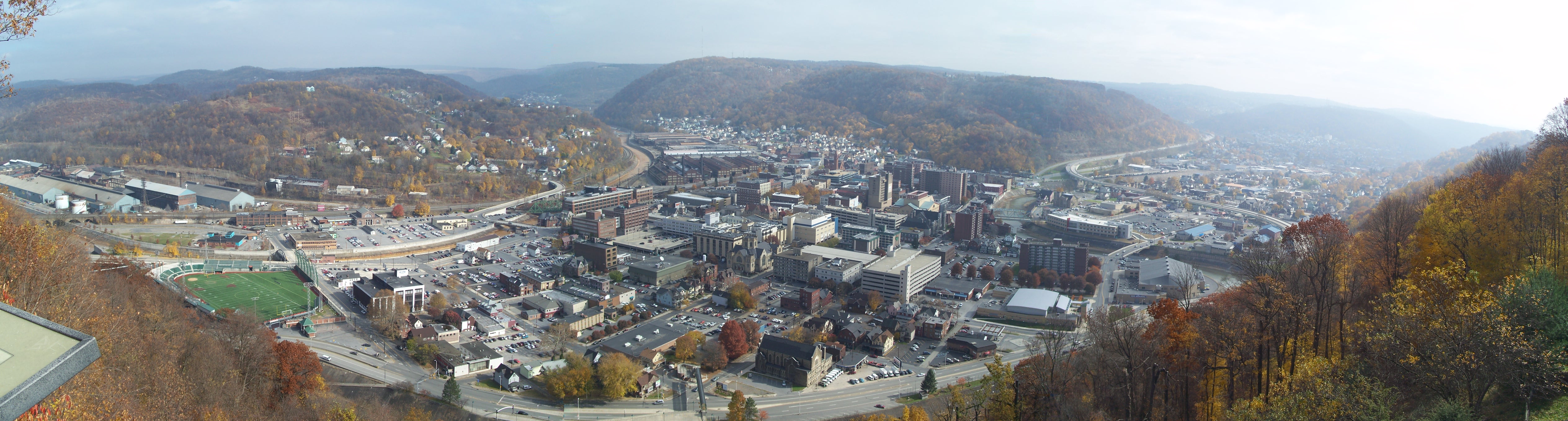
Panoramic view of Johnstown, PA
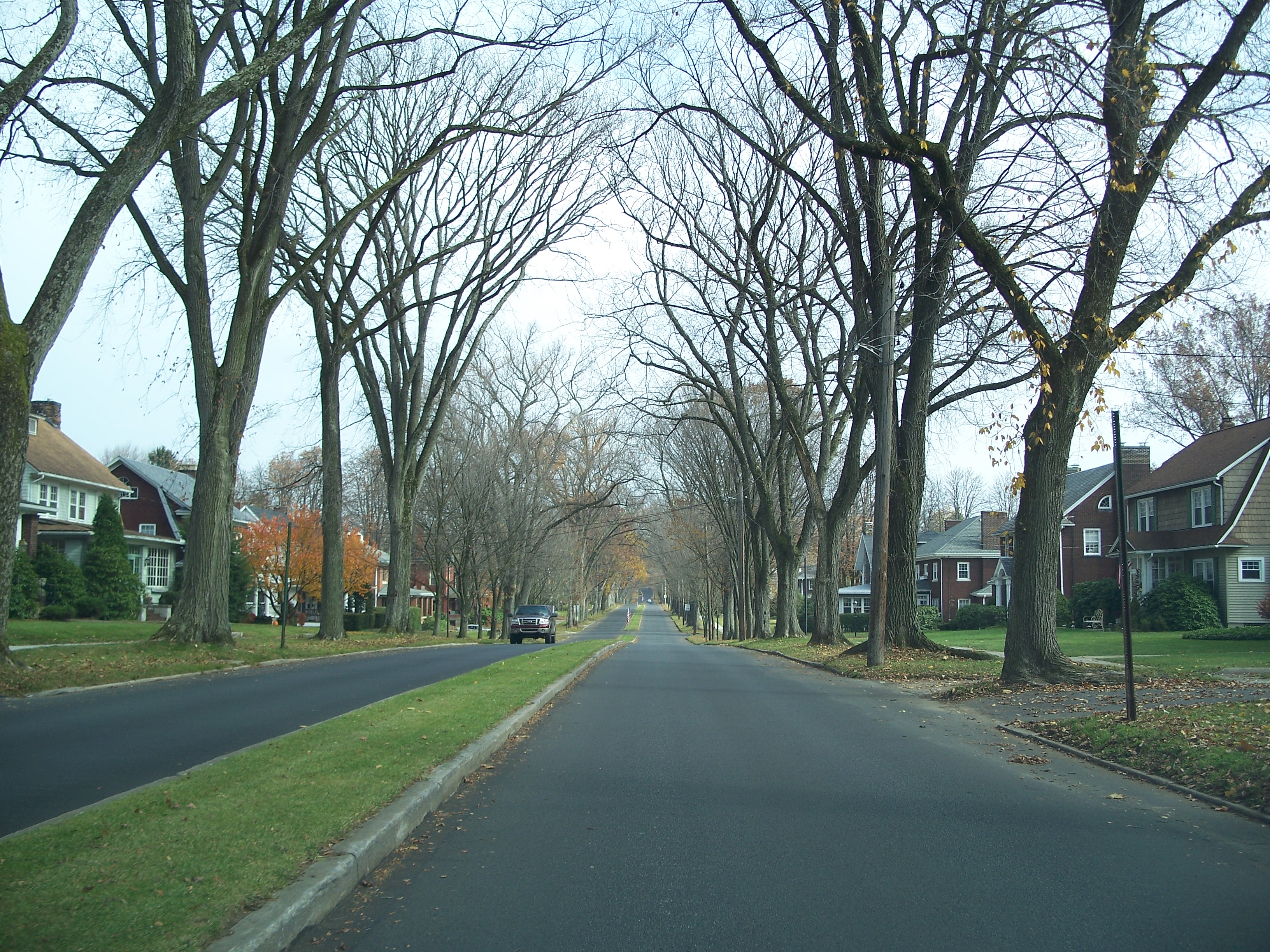
Tree-lined street in Westmont

Tree-lined street in Westmont

Johnstown flood historic marker on the observation deck

Looking down the Inclined Plane tracks
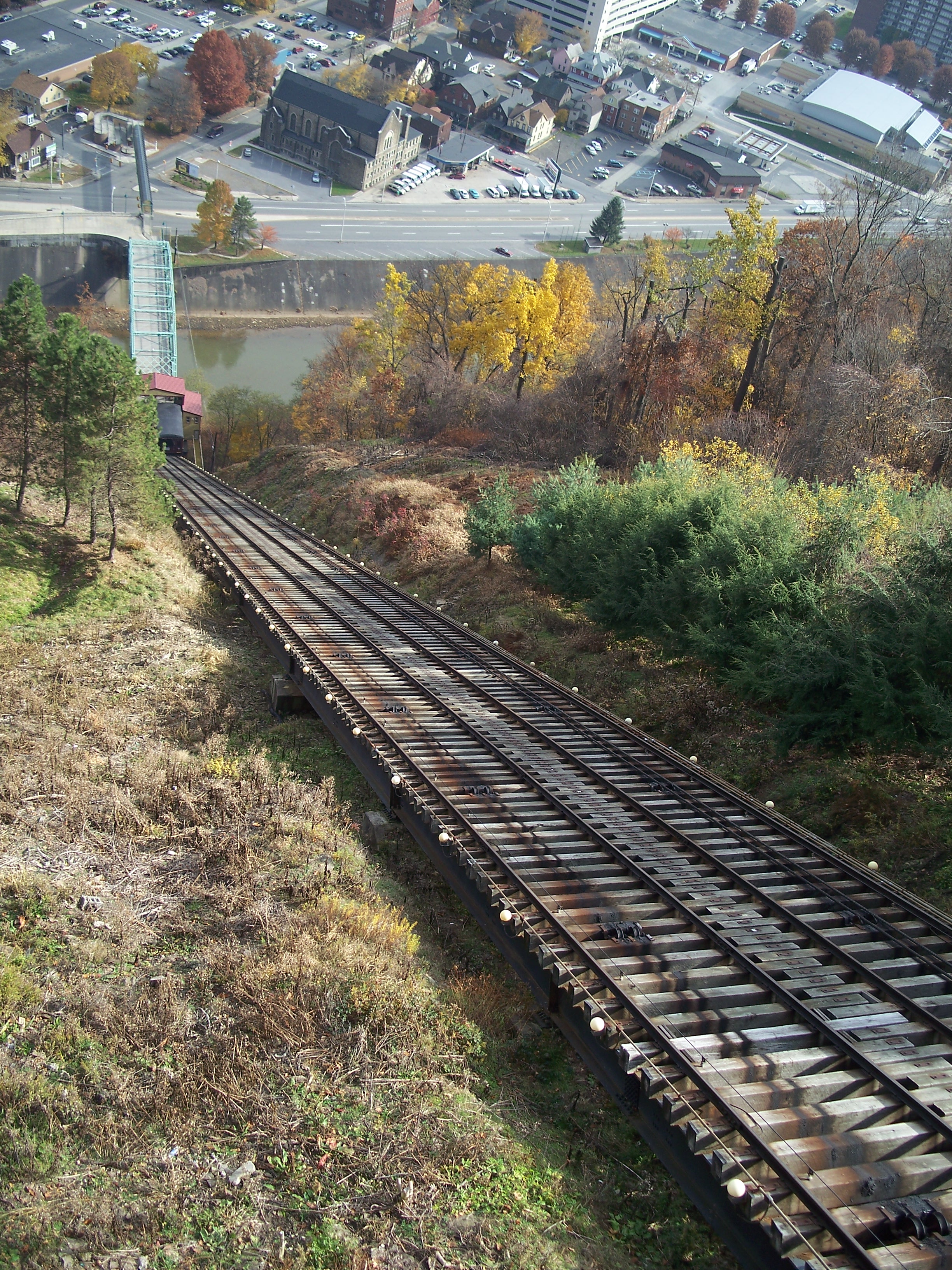
Looking town the Inclined Plane tracks
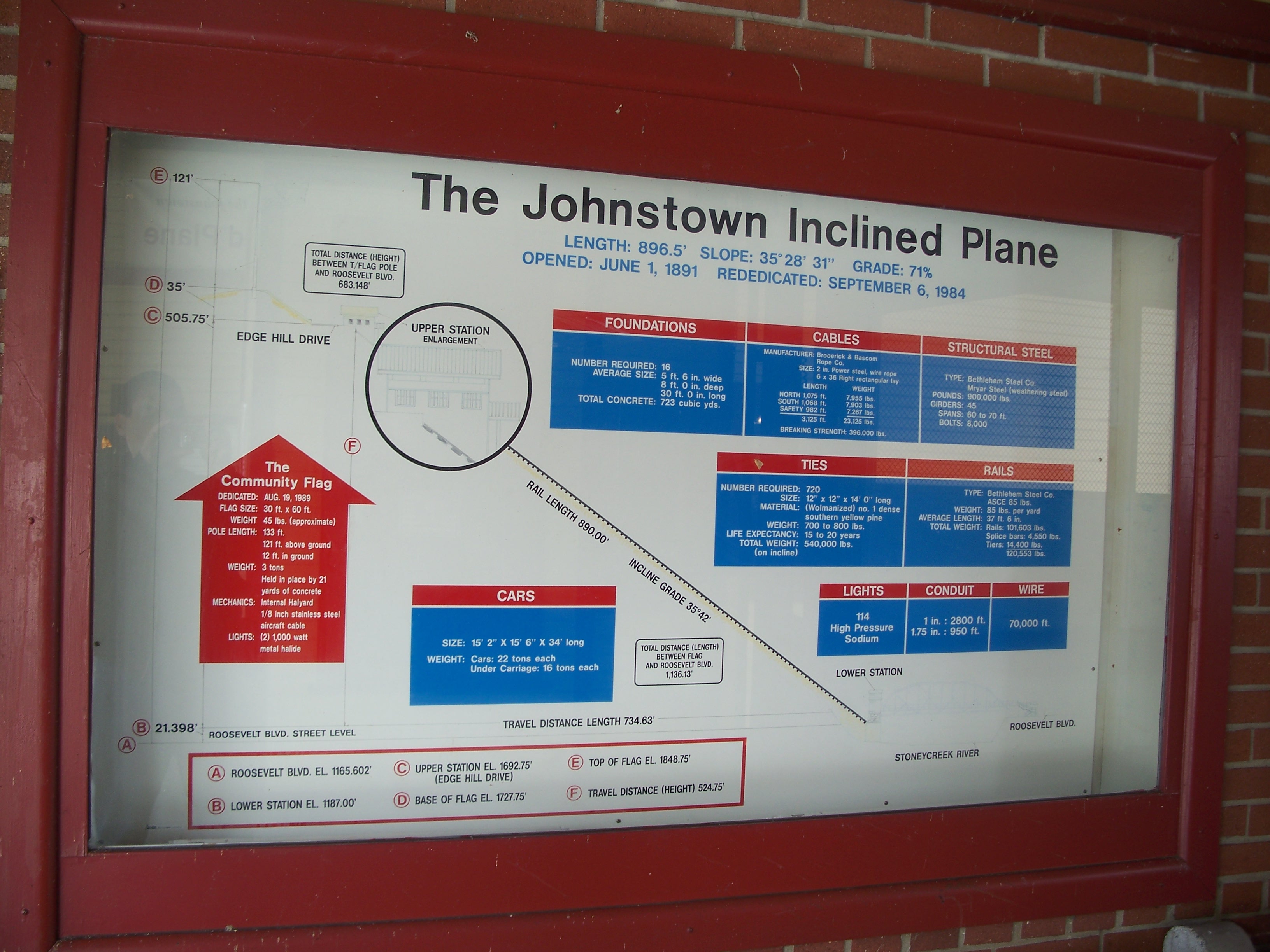
Technical info on the Inclined Plane
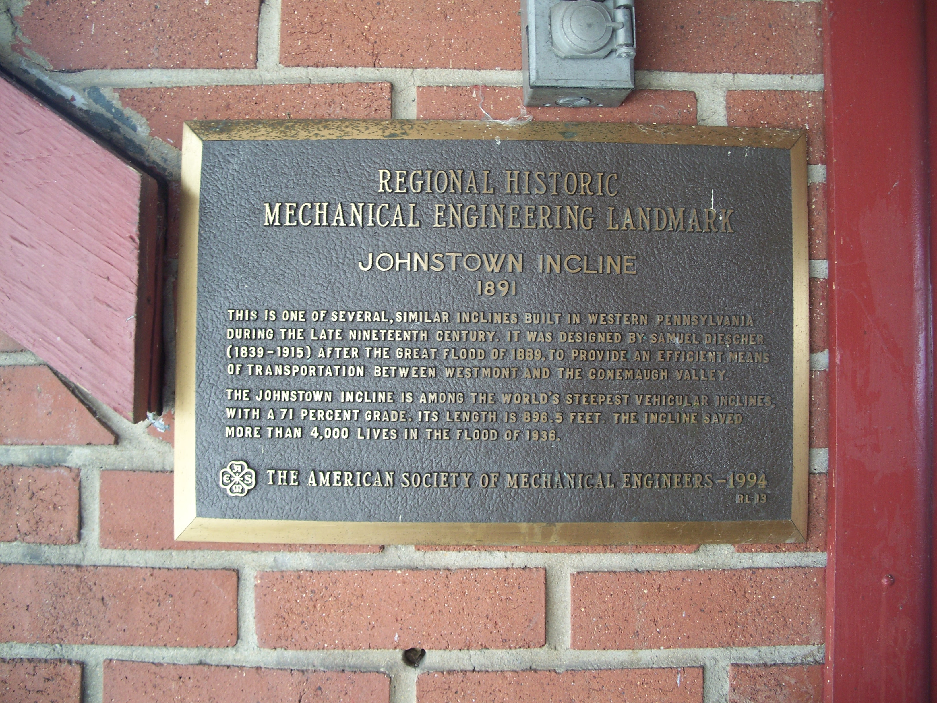
1994 ASME historical marker

Cable drive for the Inclined Plane
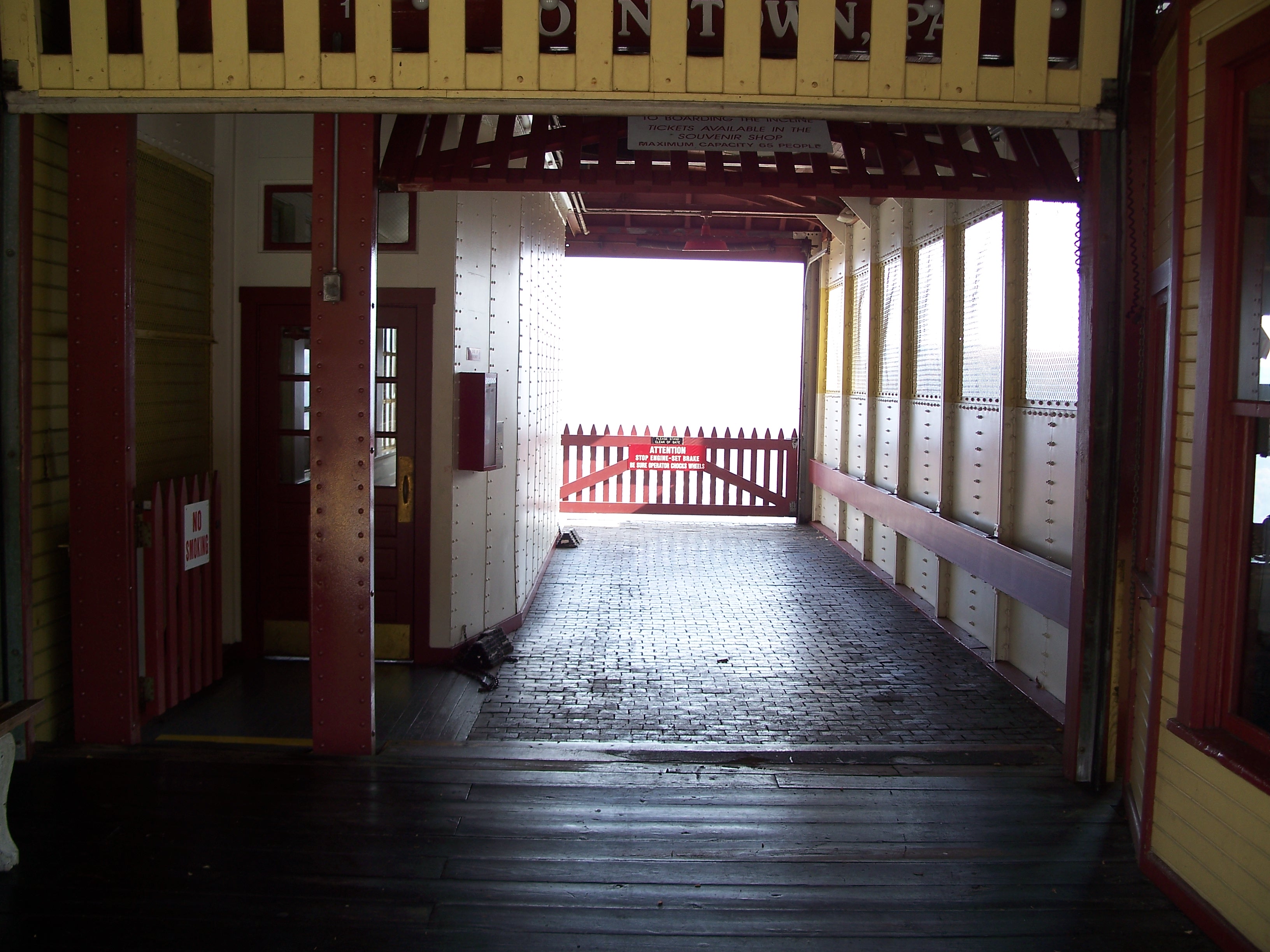
Vehicle platform and passenger compartment on the Inclined Plane

Wheel and track closeup

Looking up the Inclined Plane tracks
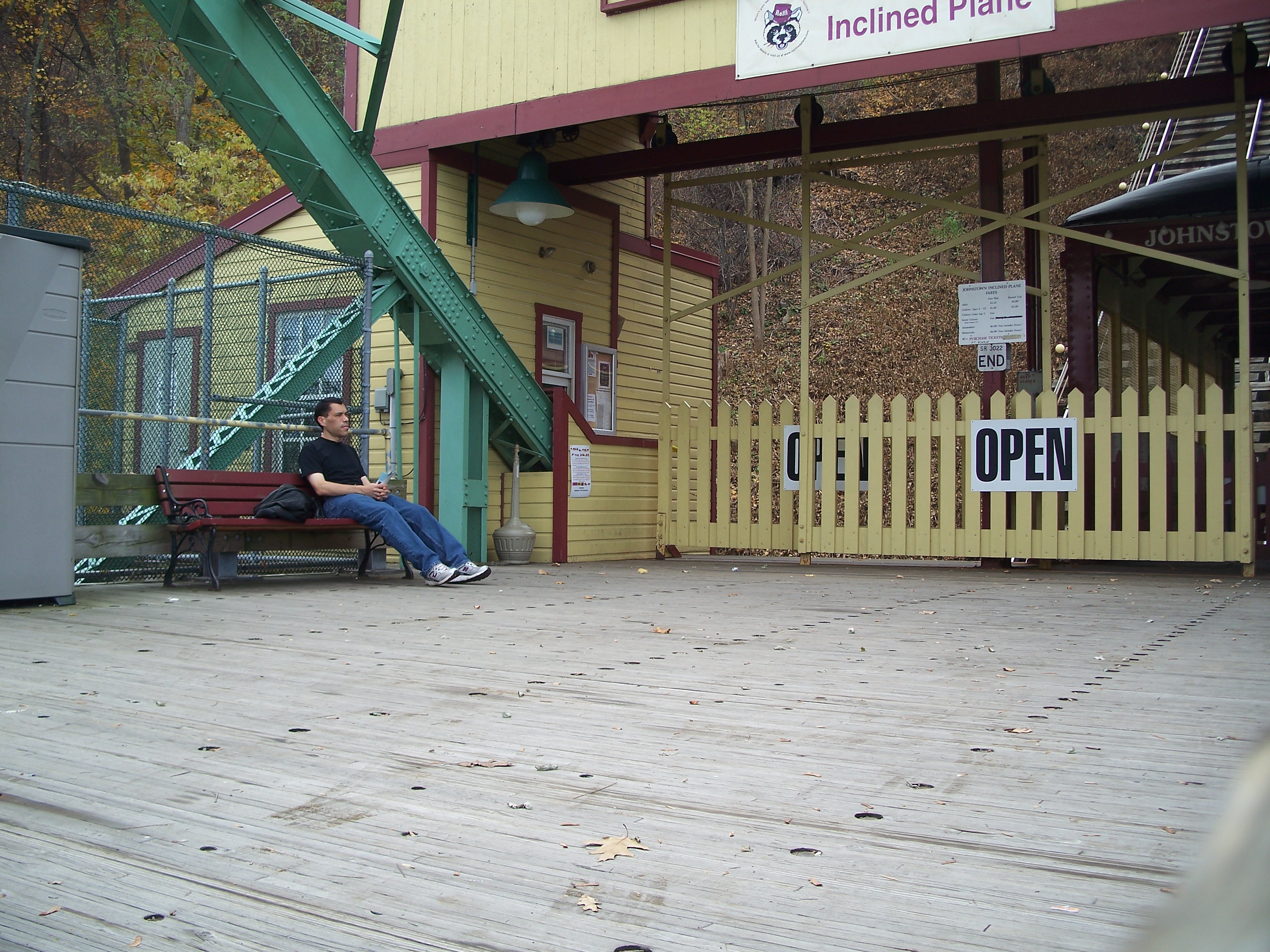
Waiting on the return train up the hill
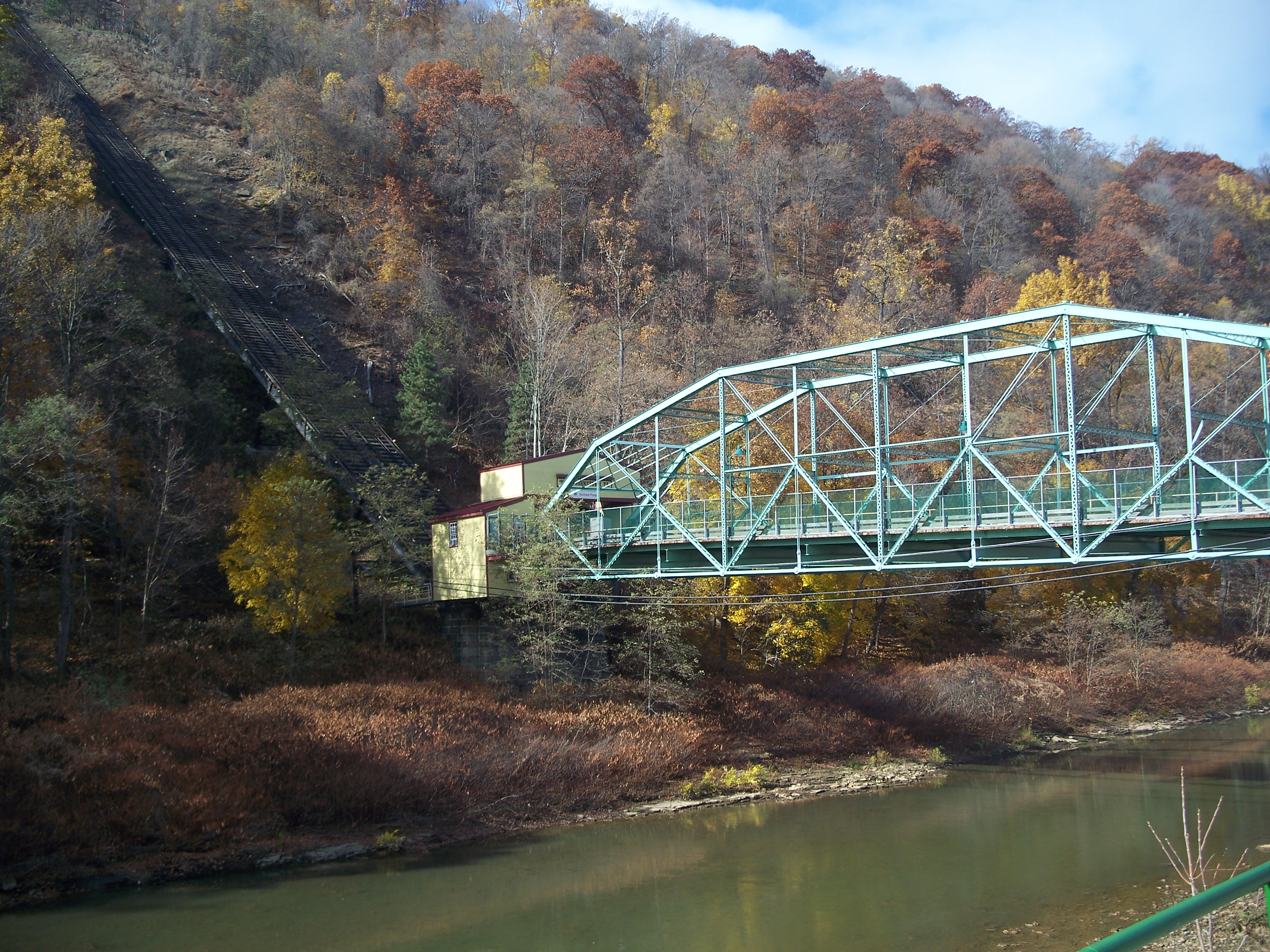
Inclined Plane Bridge lower station
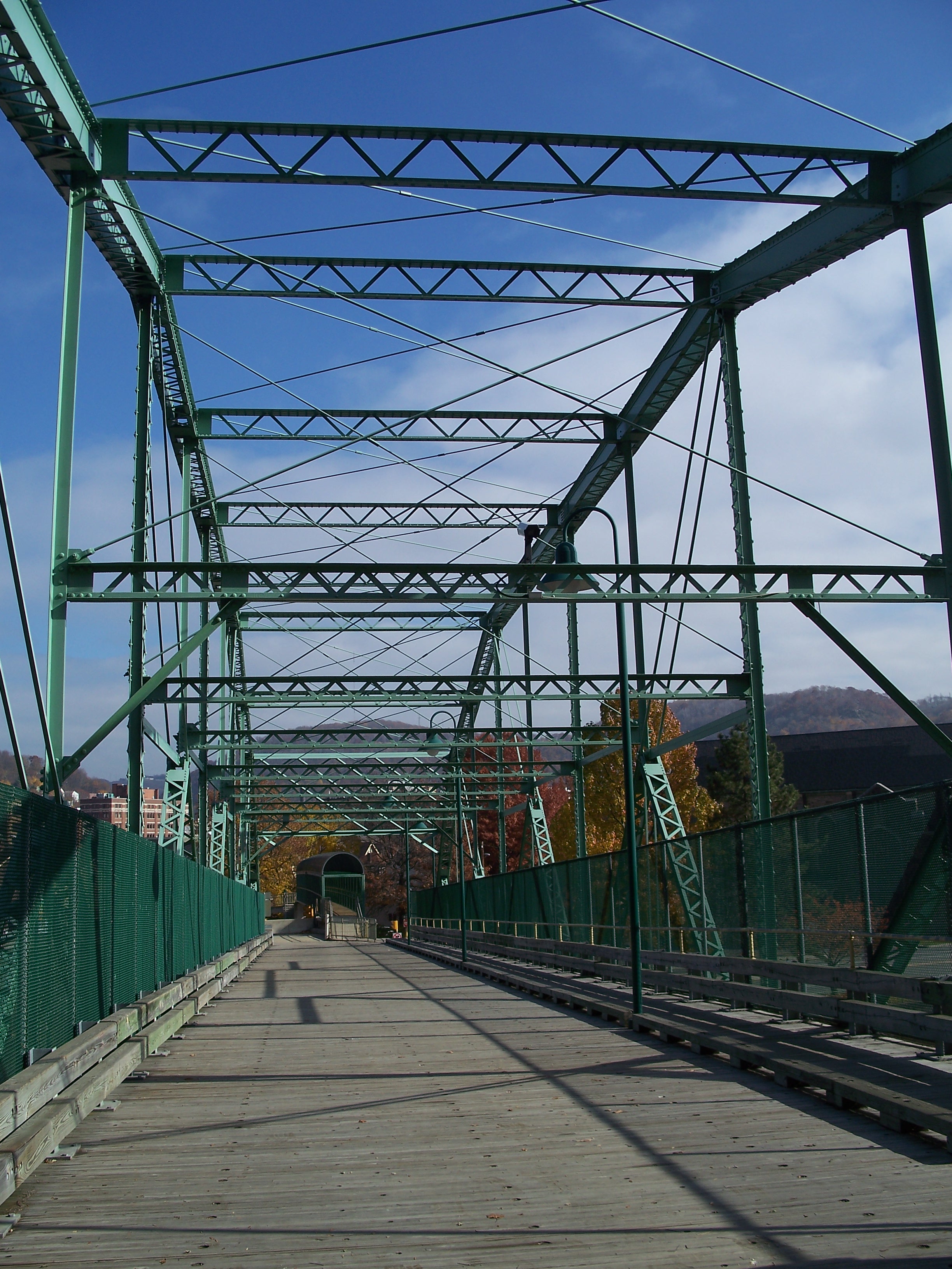
Inclined Plane Bridge looking east into Johnstown

Looking west across the bridge to the Inclined Plane lower station
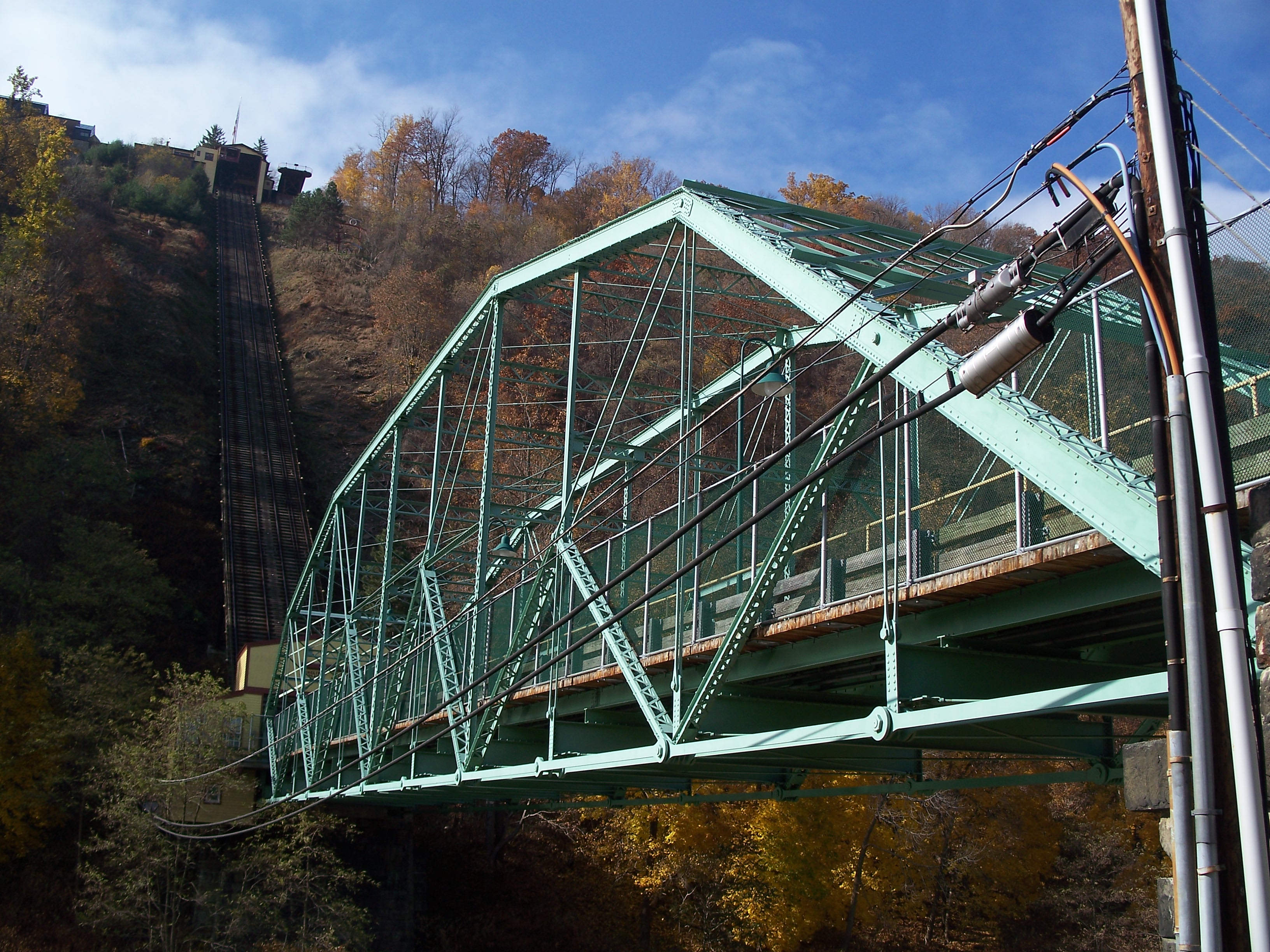
Inclined Plane Bridge viewed from the southeast
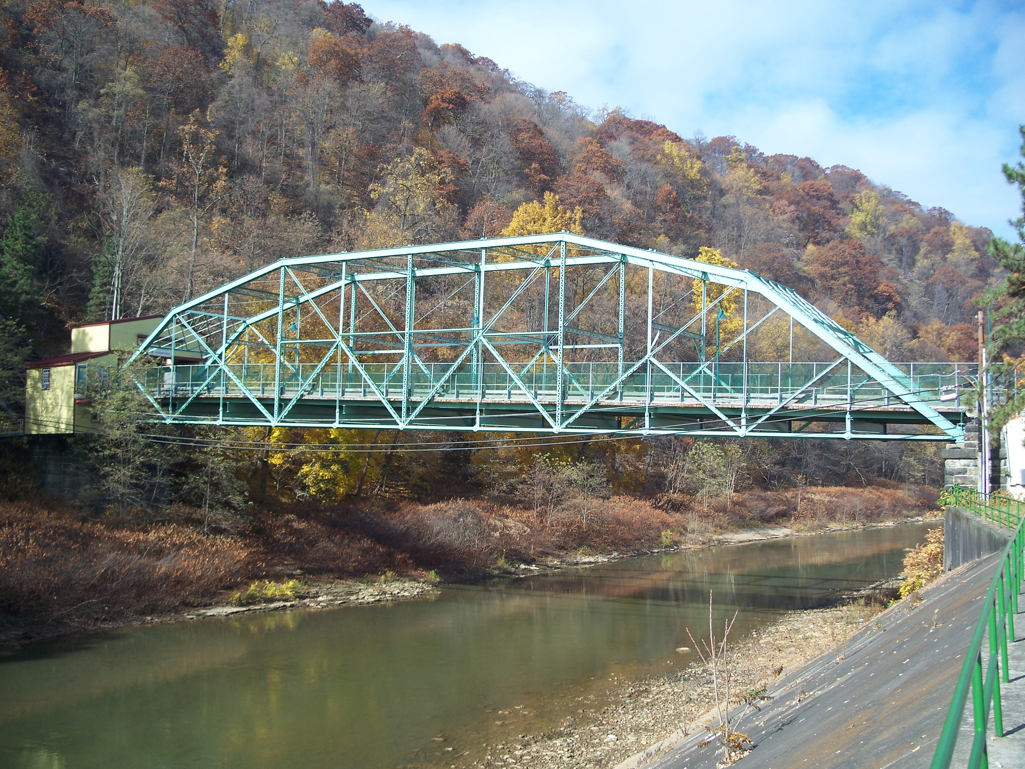
Inclined Plane Bridge viewed from the south

Vehicle ramp down to Roosevelt Boulevard