The Big Subway Gate
Cairo, IL
While I was on a children's theatre tour in 1994, we stopped for the evening just outside Cairo, IL at the Highway 3 exit from I-57. When I went for my morning jog down Highway 3 to Highway 51 south, I was startled to find a huge ancient steel flood gate looming over the entrance to the city. This sight stuck in my mind over the years and I returned to Cairo in 2002 to take some photos of the gate.
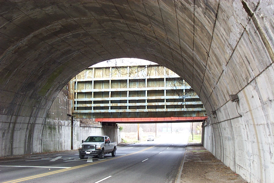
Cairo, IL is located on a peninsula between the Ohio and Mississippi rivers and has needed levees for flood protection since its inception. Tall levees were constructed during the Civil War to hold back the flood waters, which, with sporadic improvements, have held to this day through numerous major floods. The Cairo Gate can seal a tunnel (dated 1903) that takes US Highway 51 through the northern levee. The levee also serves as an approach to a railroad bridge over the Ohio River and the gate is situated between the levee and a smaller railroad bridge (dated 1904) which is painted red with "CAIRO" in large white letters.
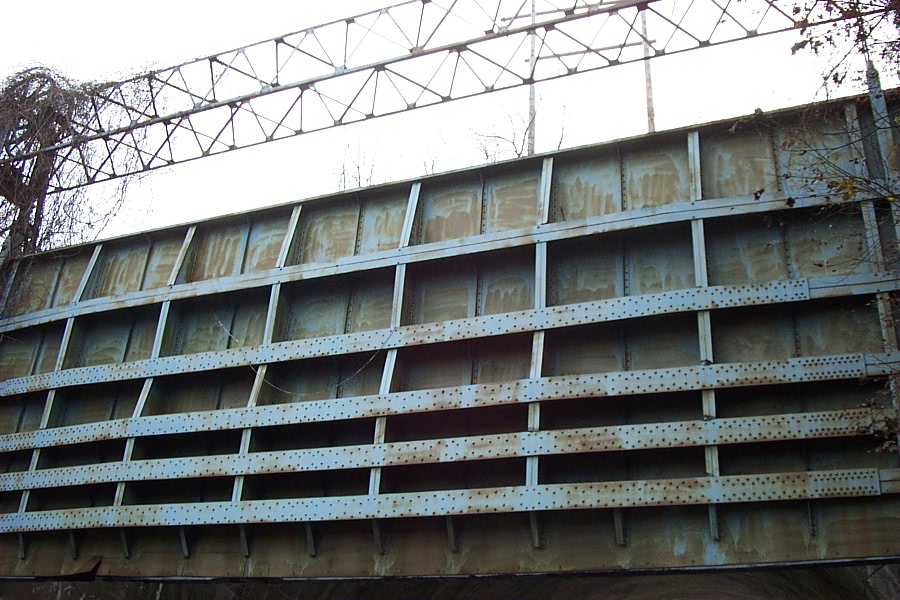
The "Big Subway Gate" was constructed in 1914 by Stupp Brothers of St. Louis, MO. The gate was built on the plan of the Gatum Dam at the Panama Canal and weighs 80 tons, is 60 feet wide, 24 feet high and five feet thick. The counterweights used to raise and lower the gate weigh almost as much as the gate itself, so that it will only require the effort of 2 men at each windless, one windless on each side of the gate, to raise the gate when it has been lowered. The cables used in the "crabs" in raising and lowering the gate are about 2 inches in thickness. Work began on the gate April 29th with the steel work commencing June 27th. The gate was completed on August 23, ten days before its scheduled completion date of September 1, 1914. On August 28, 1914, the big flood gate was given a formal test. The cost of the gate was a little more than $11,000.
Supposedly, the gate existed so that if flood waters rose to the point where they would swamp the city, the levees north of town could be dynamited to relieve water pressure. With the gate closed, the city would have become a ringed island until the waters subsided. Following the great Mississippi flood of 1927, the Army Corps of Engineers reinforced the levees around Cairo.
From the appearance of the gate and the lifting mechanism, when I first visited in 2002 it didn't appear to have been closed in the recent past. Heavy spring flooding in 2011 led to activation of the New Madrid Floodway, which involved flooding upstream fields to lower the river level and save Cairo from flooding. However, the old Cairo flood gate had obviously not been moved, confirming my suspicion that it was no longer needed or operational.

Cairo Gate
Cairo Gate

Cairo Gate

Cairo Gate

Cairo Gate

Cairo Gate
Cairo Gate

Cairo Gate

Cairo Gate

Cairo Gate

Cairo Gate
Cairo Gate

Cairo Gate

Cairo Gate

Cairo Gate

Cairo Gate

The overpass and gate

Cairo Gate

Cairo Gate

Cairo Gate

Cairo Gate

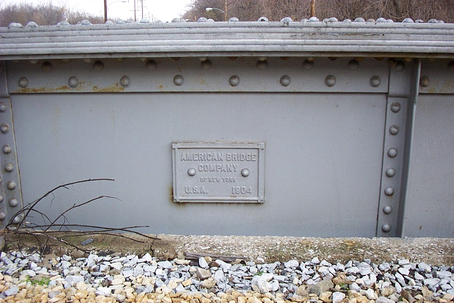
American Bridge Co. of New York, 1903